
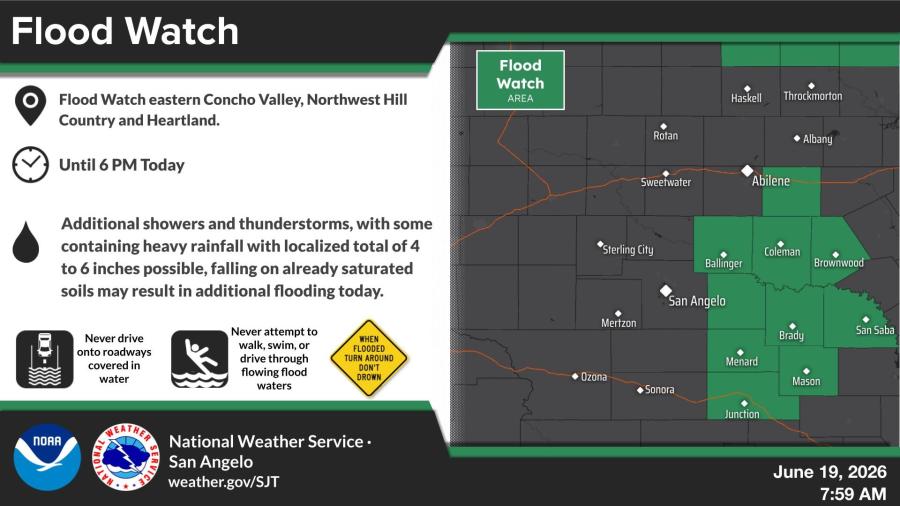
SAN ANGELO, TX — The National Weather Service has issued a flood watch until 6 p.m. today for the eastern Concho Valley, Northwest Hill Country and Heartland areas due to the potential for additional flooding from showers and thunderstorms.
Additional showers and thunderstorms are expected, with some containing heavy rainfall. Localized totals of 4 to 6 inches are possible on already saturated soils, which may result in flash flooding across the affected areas.
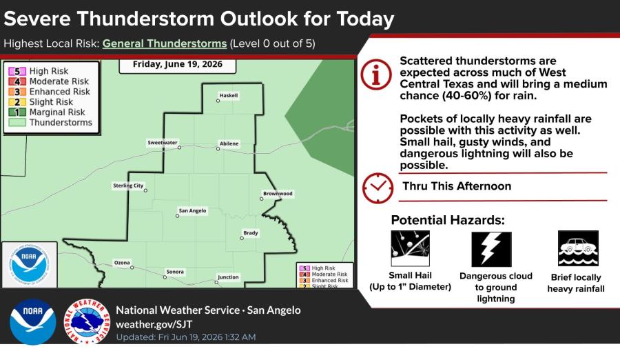
Scattered thunderstorms are forecast across much of West Central Texas through this afternoon. The highest local risk is for general thunderstorms. A medium chance of rain, 40% to 60%, is expected, along with pockets of locally heavy rainfall. Small hail, gusty winds and dangerous lightning are also possible.
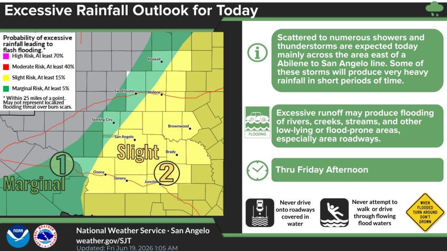
An excessive rainfall outlook shows scattered to numerous showers and thunderstorms mainly east of an Abilene to San Angelo line. Some storms may produce very heavy rainfall in short periods. There is a slight risk of excessive rainfall leading to flash flooding in some areas through Friday afternoon, according to the NWS.
The NWS advises residents to never drive onto roadways covered in water and to never attempt to walk, swim or drive through flowing flood waters.
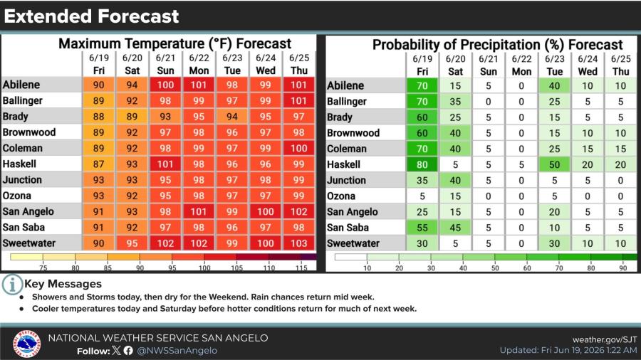
Temperatures will be cooler today and Saturday before rebounding to above normal levels for much of next week. Rain chances return midweek after a generally dry weekend.
High temperatures today are forecast in the upper 80s to low 90s across the region, with precipitation probabilities highest today before dropping sharply this weekend.


Subscribe to the LIVE! Daily

Required
Post a comment to this article here: