
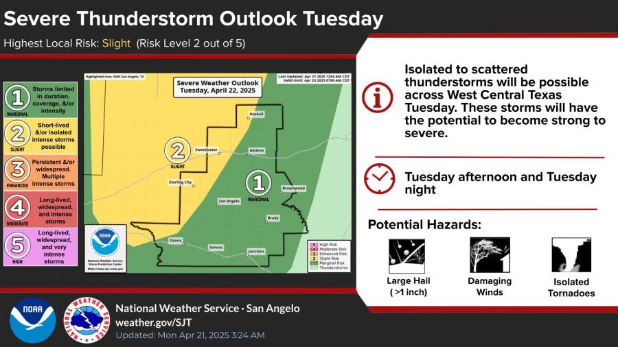
SAN ANGELO, TX — Isolated to scattered strong storms are possible Tuesday afternoon and night across West Central Texas, with San Angelo under a marginal to slight risk for severe thunderstorms, according to the National Weather Service.
The primary threats include large hail greater than one inch in diameter, damaging winds, and the potential for isolated tornadoes. Areas north and west of San Angelo, including Sterling City and Sweetwater, are under a slight risk (level 2 of 5) for severe weather, while much of the rest of the region remains at marginal risk.
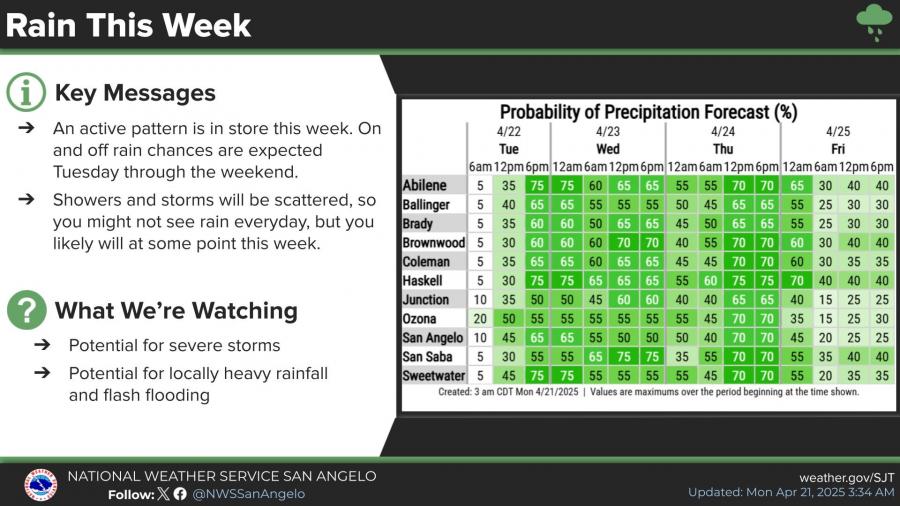
Storm chances begin after 1 p.m. Tuesday and continue overnight. Rainfall could total between a quarter and half an inch, with higher localized amounts possible in thunderstorms. The active pattern is expected to continue through the weekend, with multiple rounds of scattered showers and storms forecast from Tuesday through Saturday.
The highest precipitation chances for San Angelo this week are 65 percent on Tuesday evening and 70 percent on Thursday. Locally heavy rainfall could lead to flash flooding in low-lying areas.
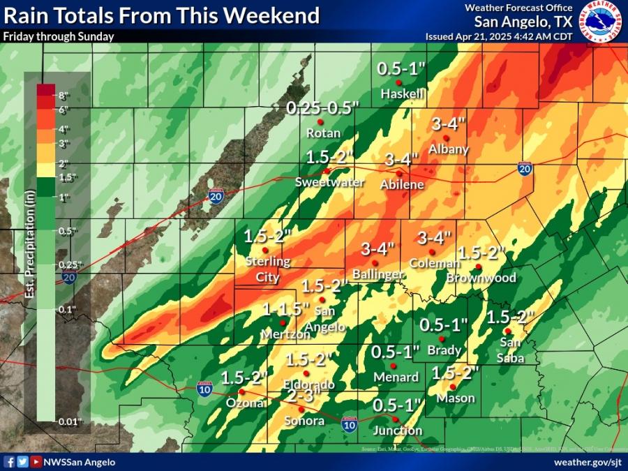
Over the weekend, widespread rainfall brought 1 to 2 inches across San Angelo, with heavier totals between 2 to 4 inches north of a Mertzon-to-Brownwood line. The Abilene Airport recorded 3.82 inches, while San Angelo Airport reported 1.44 inches.


Subscribe to the LIVE! Daily

Required
Comments
Listed By: Wiley Coyote
BRING IT!!!
- Log in or register to post comments
PermalinkPost a comment to this article here: