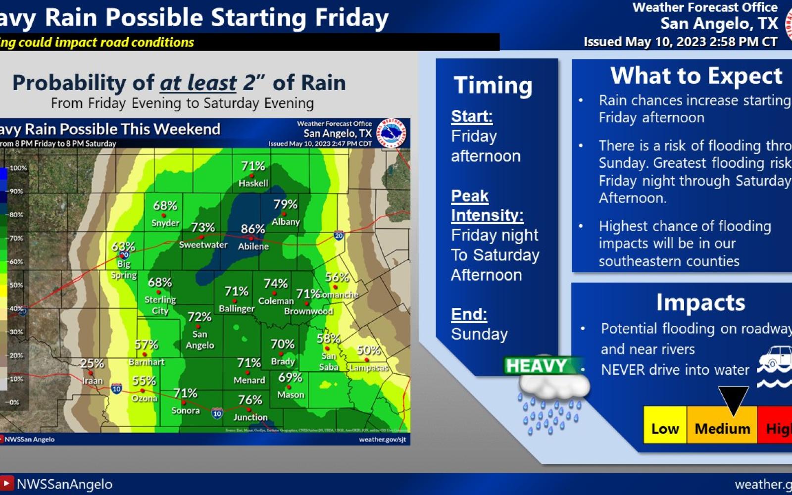
SAN ANGELO – A strong storm system will move across West Central Texas Friday afternoon packing large hail and torrential rain to kick off a rain-soaked, flood filled weekend.
According to the Meteorologists at the National Weather Service office in San Angelo, Flash Flood Watches have already been issued for the western counties of the Concho Valley and are anticipated across the entire area by Friday afternoon.
A squal line will develop ahead of a pacific frontal system roughly along I-20 stretching from Midland/Odessa to Abilene and Clyde. That line of thunderstorms will contain severe thunderheads and increase in intensity as it moves east across the Big Country, Concho Valley and Heartland Friday night.
Large hail, damaging winds, then torrential flooding are the main threats with the storm system. An isolated tornado is possible as well.
The storm system will move very slowly across the region and behind the squal line, almost stationary thunderstorms with heavy rain will park over the area Saturday into Sunday. Widespread flooding is expected. Watch for the Flash Flood Watches to be upgraded to Flash Flood Warnings in areas that see the heaviest rain early Saturday continuing through the weekend.
A Severe Thunderstorm Watch is in effect until 10 p.m. Friday.
A Flash Flood Watch is in effect for the area from 7 p.m. Friday through Saturday evening.
The NWS is basically forecasting up to 2 inches of rain Saturday and 2 inches of rain Sunday with an additional 2 inches possible with the heavier storms. There is an 80% chance of precipitation from Friday afternoon to Monday with reduced chances through midweek.
This is a serious storm and the largest rain event of the year so far. Prepare accordingly.
San Angelo LIVE! will update this information as the weekend progresses and as needed.

Weekend Rain Graphic 5.12.23 (Courtesy/NWS)
Subscribe to the LIVE! Daily
Required


Comments
Yantis:
Your continual NWS weather discussions in the form of cut and paste work well for you. May I now assist in some other areas of improvement.
1. Squall not Squal
2. Thunderstorm not Thunderhead. Yes there is such a thing as a thunderhead but not all thunderheads rain. Thunderhead. That can take one back to the AC/DC song Thunderstruck. OK, I'll give you a pass on that one.
3. "This is a serious storm and the largest rain event of the year so far."
How can it be the largest rain event of the year if it has yet to occur?
Once the dust settles (no pun intended), I'd be happy to give you updated reservoir gains and peak river flows. You know who to call, I think.
- Log in or register to post comments
PermalinkPost a comment to this article here: