SAN ANGELO, TX — The National Weather Service (NWS) has issued a warning for another round of severe thunderstorms expected to hit this afternoon and evening.
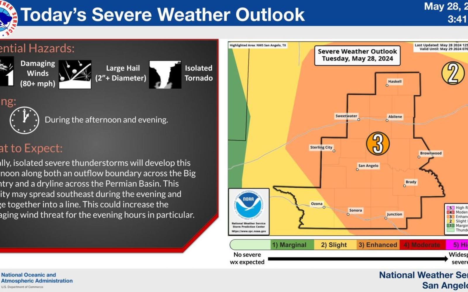
Meteorologists are still determining the exact timing and location of the storms, as ongoing activity across the Red River influences their development. However, the NWS provided a general forecast for the expected severe weather:
- Afternoon Development: Scattered storms are anticipated to develop after 4 p.m., with very large hail, potentially larger than golf balls and closer to baseball size, being the primary concern. An isolated tornado is also possible.
- Evening Squall Line: As the evening progresses, the storms are expected to increase in coverage and form a “Texas squall line.” Damaging winds, with gusts potentially reaching near 80 mph, are a major concern. These wind speeds are comparable to those of hurricane force and stronger than many weak tornadoes.
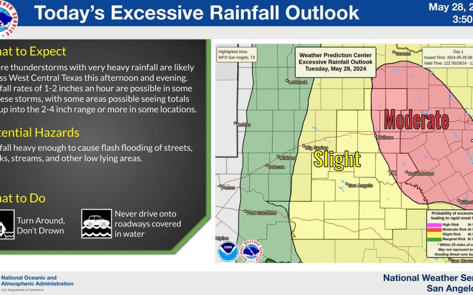
- Heavy Rainfall and Flooding: Prolonged rainfall during the evening could lead to heavy downpours, with the possibility of 1-2 inches of rain in a short period. If multiple storms pass over the same area, rainfall totals could reach 2-4+ inches, raising the threat of flash flooding.
Copyright
National Weather Service
Source
National Weather Service
Authored on
"Hopefully we will all catch a break and it won't be as bad as it could be," stated the NWS. "But we have to encourage you to be prepared in case it is."
Copyright
National Weather Service
Source
National Weather Service
Authored on
Subscribe to the LIVE! Daily
Required




Post a comment to this article here: