
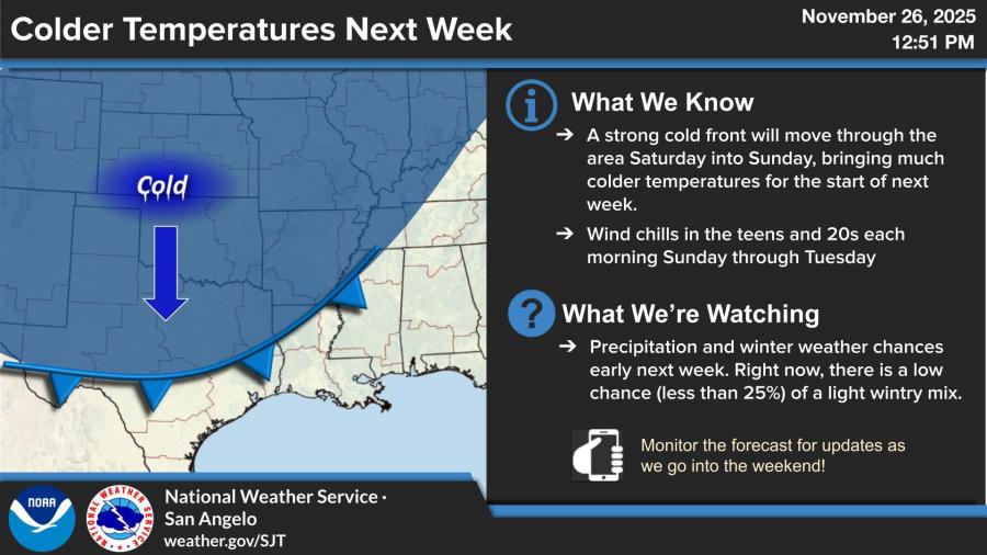
SAN ANGELO, TX — West Central Texas will see a mild Thanksgiving before a strong cold front arrives this weekend, bringing wind chills in the teens and 20s and a chance—albeit low—of wintry precipitation early next week, according to the National Weather Service.
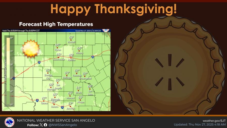
Forecasters said Thursday will be pleasant across the region, with light winds and afternoon highs in the low to mid-60s. San Angelo is expected to reach the mid-60s with calm east-southeast winds around 5 mph.
Conditions begin to change Friday as clouds increase and a 30% chance of showers develops after noon. Friday’s high will be near 63 degrees, followed by breezy conditions Friday night with another slight chance of rain.
The strongest shift arrives Saturday into Sunday when a powerful cold front pushes through the region. Highs will reach the mid-70s Saturday before temperatures fall sharply overnight, dropping to around 30 degrees by Sunday morning. Sunday’s high is forecast near 46 degrees with north-northeast winds of 10–15 mph.
Wind chills are expected to fall into the teens and 20s each morning from Sunday through Tuesday.
The National Weather Service said it is monitoring the potential for a light wintry mix early next week, but the current probability remains low—less than 25%. Monday’s high is expected near 51 degrees before conditions gradually warm again into midweek.


Subscribe to the LIVE! Daily

Required
Post a comment to this article here: