
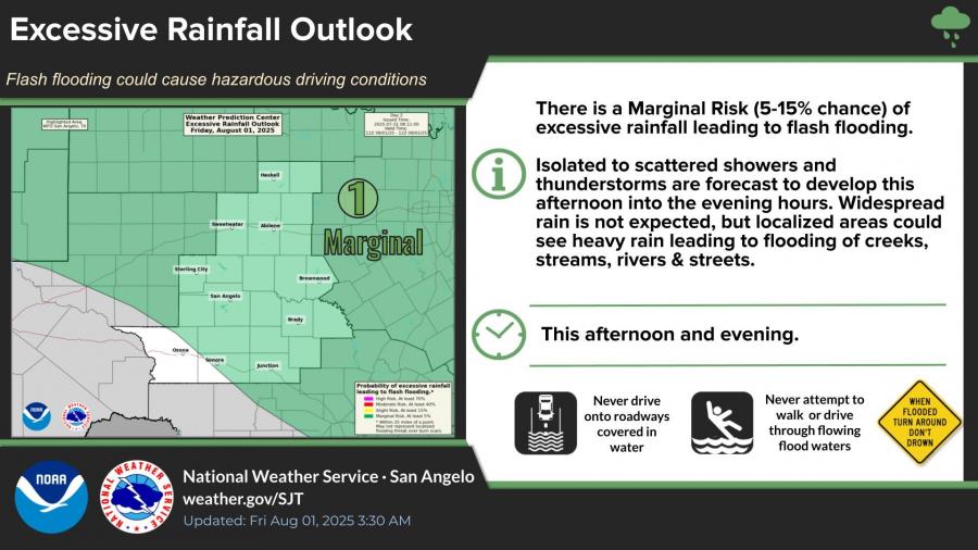
SAN ANGELO, TX — The National Weather Service in San Angelo has released a marginal risk for excessive rainfall Friday, with a 5-15% chance of flash flooding across much of West Central Texas.
Isolated to scattered showers and thunderstorms are expected to develop Friday afternoon and evening. While widespread rainfall is not anticipated, localized heavy rain could cause flooding of creeks, streams, rivers and streets.
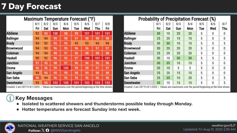
San Angelo has a 25% chance of rain Friday, with a high near 94 degrees. Showers and thunderstorms remain possible through Monday, with rain chances gradually decreasing over the weekend.
Temperatures will climb next week, with highs in San Angelo forecast to reach the upper 90s to near 100 degrees by Sunday and early next week.
The NWS advises motorists not to drive onto roadways covered in water and to avoid walking or driving through floodwaters.
At San Angelo Airport, the city recorded its hottest and coolest July temperatures on the same day yesterday, with a morning low of 62 degrees and an afternoon high of 99 degrees, according to the NWS.
You can find the detailed forecast HERE.


Subscribe to the LIVE! Daily

Required
Post a comment to this article here: