

SAN ANGELO, TX — Additional showers and thunderstorms are possible in San Angelo late Tuesday morning into the afternoon, with the highest chances arriving Wednesday night into Thursday night as an upper-level low drifts north, the National Weather Service said.
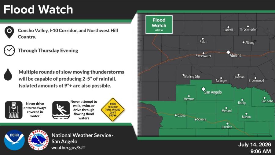
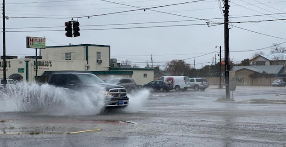
Officials noted that a few parts of town saw rain Monday, but it was very hit or miss. A flood watch remains in effect through Thursday evening for the Concho Valley, including the San Angelo area, along with the Interstate 10 corridor and Northwest Hill Country. Multiple rounds of slow-moving thunderstorms are expected to produce 2 to 5 inches of rain across the watch area, with isolated totals of 9 inches or more possible in some spots.
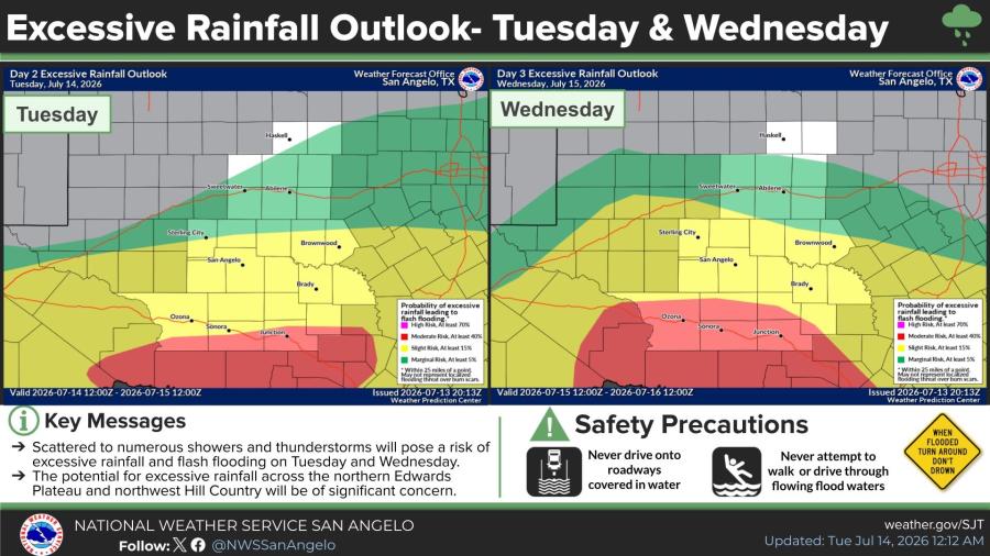
An excessive rainfall outlook for Tuesday and Wednesday shows elevated risks of flash flooding, particularly across the northern Edwards Plateau and northwest Hill Country, with scattered to numerous showers and thunderstorms forecast to bring locally heavy rain.
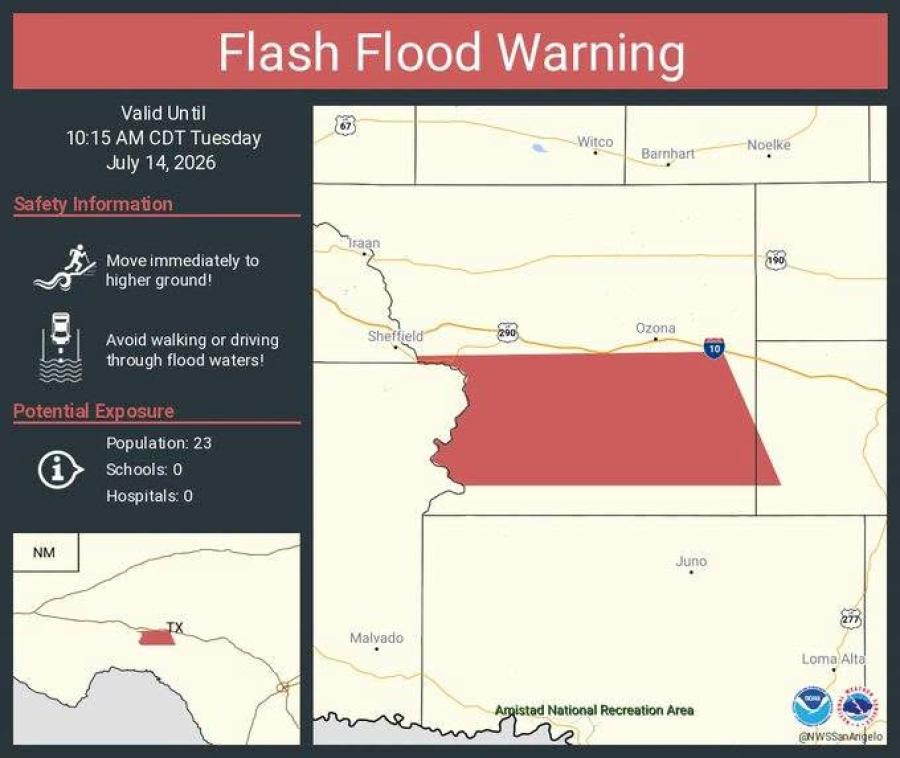
A separate flash flood warning was issued Tuesday morning for much of Crockett County and areas east through Sonora due to overnight rainfall totals that exceeded 5 inches in some places. The warning was set to expire at 10:15 a.m.
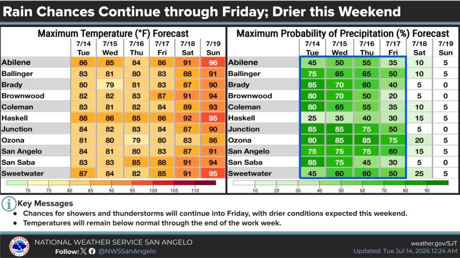
Looking further ahead, rain chances will continue across west central Texas through Friday before drier conditions are expected this weekend. High temperatures in San Angelo are forecast to stay near or below normal, ranging from the low 80s to mid-80s through the period.

Subscribe to the LIVE! Daily
Required
Post a comment to this article here: