

SAN ANGELO, TX — Hot weather will persist across west-central Texas on Wednesday, with highs ranging from the mid-90s to around 100 degrees and a 15% to 20% chance of isolated to scattered thunderstorms, mainly in eastern and southern counties, the National Weather Service said.
Abilene has already reached or exceeded 100 degrees 50 times this year, well above its average of 19 such days. San Angelo has recorded 40 days of 100 degrees or higher, compared with an average of 30. Both cities were expected to top out near 100 again Wednesday afternoon.
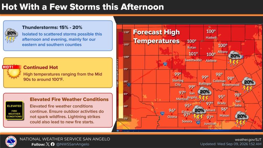
Most of the region will stay dry, but any storms that develop this afternoon or early evening could produce heavy rainfall and gusty winds. Coverage of showers and thunderstorms is forecast to be a bit better Thursday afternoon and evening, with chances of 20% to 35% in some locations. Hot conditions will continue through early next week.
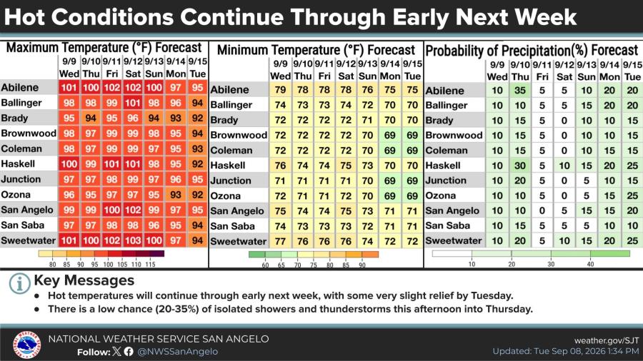
Forecast highs through next week include 102 in Abilene and San Angelo on Saturday, with several other locations reaching 100 to 103 degrees Friday through the weekend before a slight cooldown into the mid-90s by Tuesday. Overnight lows will generally remain in the low to mid-70s. Elevated fire weather conditions persist.
The weather service urged residents to avoid outdoor activities that could spark wildfires. Lightning from any storms could also start new fires.

Subscribe to the LIVE! Daily

Required
Post a comment to this article here: