

SAN ANGELO, TX — The National Weather Service has issued a marginal risk of excessive rainfall for west-central Texas on Sunday and a slight risk on Monday, with scattered showers and thunderstorms expected to bring the potential for locally heavy rain and flash flooding in some areas.
Isolated to scattered storms are forecast to develop this afternoon and evening across the region, including areas around Abilene and San Angelo. Most locations are not expected to see significant rainfall, but some spots could receive locally heavy amounts, raising the risk of flash flooding, especially in urban and flood-prone areas. Stronger storms may also produce gusty winds.
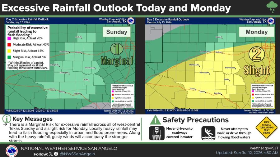
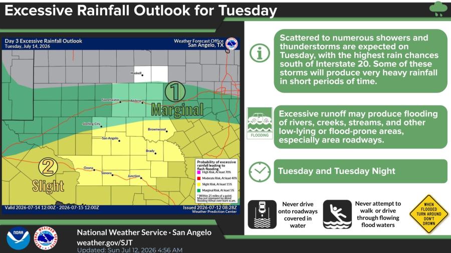
Storm coverage is expected to increase Monday into Tuesday. On Tuesday, scattered to numerous showers and thunderstorms are forecast, with the highest chances south of Interstate 20. Some storms could produce very heavy rainfall in short periods, leading to excessive runoff and flooding of rivers, creeks, streams and other low-lying or flood-prone areas, including roadways.
Temperatures are forecast to trend cooler early next week as rain chances rise. Highs Sunday are expected in the low to mid-90s before dropping to the mid to upper 80s Monday and Tuesday, continuing through the end of the week.
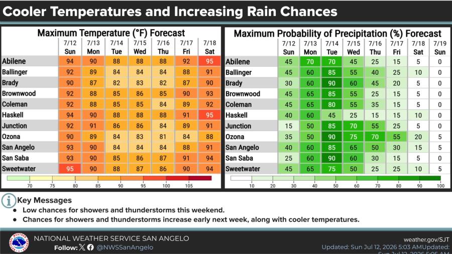
Maximum precipitation probabilities are expected to peak Monday and Tuesday, reaching 60% to 90% in several spots across the region before decreasing midweek.



Subscribe to the LIVE! Daily

Required
Post a comment to this article here: