

SAN ANGELO, TX — A line of strong to severe thunderstorms will sweep east across West Central Texas this afternoon and evening, bringing large hail, damaging winds, an isolated tornado threat and heavy rain that could trigger flash flooding on already saturated ground, the National Weather Service said Tuesday.
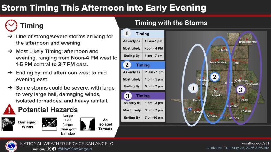
The main storm line is expected to reach the San Angelo, Sweetwater and Ozona areas between 1 p.m. and 4 p.m., the Abilene, Eldorado and Sonora areas from 3 p.m. to 6 p.m., and the Coleman, Brady, Brownwood, Mason and Junction areas from 5 p.m. to 9 p.m., forecasters reported. Most activity should end by mid-afternoon in the west and mid-evening farther east.
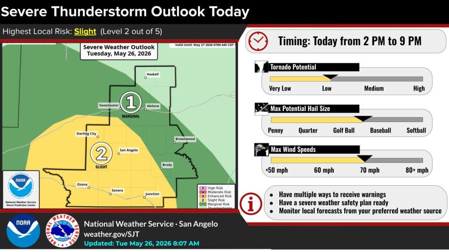
The National Weather Service’s San Angelo office placed much of the region south of Interstate 20 under a Slight risk (Level 2 out of 5) for severe thunderstorms. Pockets of stronger storms are possible, with hail up to golf-ball or baseball size, wind gusts near 70 mph and a low tornado threat — particularly near Ozona, Eldorado, Sonora and the southwest Concho Valley.
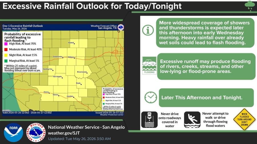
Forecasters also issued an Excessive Rainfall Outlook for the area, noting that additional heavy rain later this afternoon into early Wednesday morning could produce flash flooding, especially in low-lying areas, along creeks and across roads where water is already standing.
“Never drive onto roadways covered in water” and “Never attempt to walk or drive through flowing flood waters,” the NWS warned.

Subscribe to the LIVE! Daily

Required
Post a comment to this article here: