
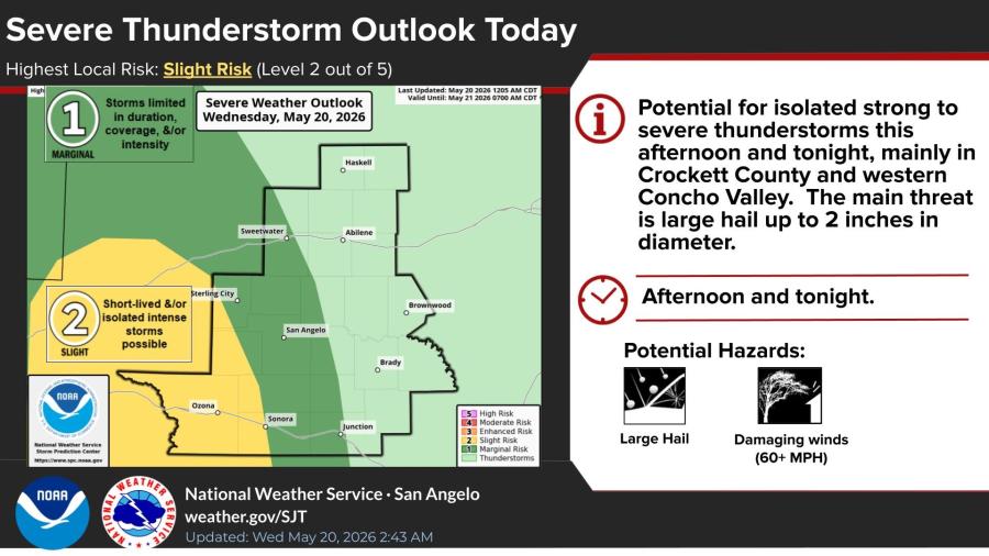
SAN ANGELO, TX — Scattered showers and thunderstorms, some of which could become severe, are expected to develop across West Central Texas this afternoon and tonight as a cold front moves through the region, the National Weather Service in San Angelo reported Wednesday.
The NWS placed parts of the area under a Slight Risk (Level 2 of 5) for severe thunderstorms, mainly in Crockett County and the western Concho Valley. A second, stronger band of storms is forecast to move west to east beginning mid-evening, with the I-10 corridor among the most unstable areas. The primary threats are large hail up to 2 inches in diameter and damaging winds of 60 mph or greater.
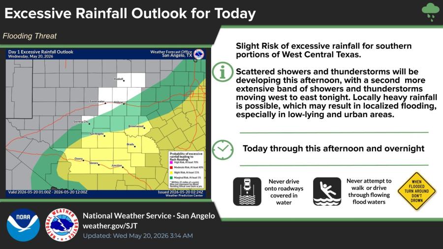
Forecasters also issued a Slight Risk of excessive rainfall for southern portions of West Central Texas. Scattered showers and thunderstorms this afternoon, followed by a more extensive band tonight, could produce locally heavy rain and localized flooding, especially in low-lying and urban areas. Drivers are urged not to drive through flooded roadways or attempt to walk or drive through moving water.
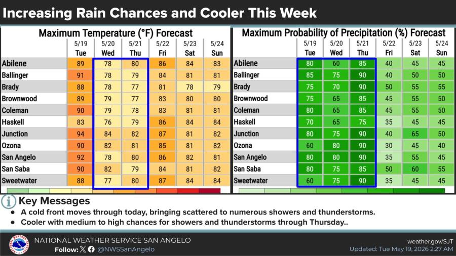
Rain chances are expected to remain medium to high — generally 60% to 90% — through Thursday. High temperatures Wednesday will be noticeably cooler than recent days, mostly in the upper 70s to low 80s, compared with the upper 80s and low 90s on Tuesday. Similar rain chances and highs near 80 degrees are forecast for Thursday.
The NWS forecast discussion noted that some storms could become severe this afternoon and evening where instability increases, particularly south and west of the Junction line, with large hail as the main threat. A cold front is bringing the increased moisture and storm potential.
Chances for showers and thunderstorms will decrease after Thursday as the upper-level pattern shifts, though the overall setup remains active into early next week.

")

Subscribe to the LIVE! Daily

Required
Post a comment to this article here: