
SAN ANGELO, TX — The National Weather Service in San Angelo has placed southeast counties under a slight risk of severe thunderstorms Tuesday afternoon, with large hail and damaging winds as the primary threats.
An isolated thunderstorm is possible late Tuesday afternoon, mainly across southeast counties, according to the NWS outlook issued Tuesday morning. If a storm develops, it will likely become severe, forecasters said. The main hazards will be large hail up to golf ball size and damaging winds of 60 mph or greater. Cloud-to-ground lightning is also expected. Additional storms are possible toward daybreak Wednesday, mainly across southern counties.
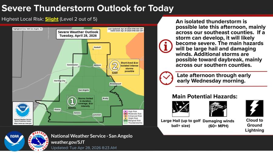
The severe thunderstorm outlook for Tuesday, April 28, shows the highest local risk as “slight,” or Level 2 out of 5. A yellow risk area covers portions of the region including areas near Haskell, Abilene and Brownwood, while most of the rest of the area is under a marginal risk. The NWS canceled a severe thunderstorm watch for Haskell and Throckmorton counties Tuesday morning after storms moved northwest of the area.
Late afternoon through early Wednesday morning is the main time frame for any activity.
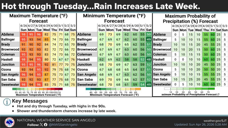
Temperatures will remain hot and dry through Tuesday, with highs in the mid- to upper 90s across the region. San Angelo is forecast to reach 95 degrees, Abilene 96 degrees and similar readings in Brownwood, Sweetwater, Ballinger and other communities. Lows Tuesday night will be in the mid- to upper 60s.
Shower and thunderstorm chances increase later in the week, with the highest probabilities of precipitation — 50% to 60% — forecast for Thursday through Saturday in most locations. Temperatures are expected to trend cooler by late week.


Subscribe to the LIVE! Daily

Required
Post a comment to this article here: