
SAN ANGELO, TX - The National Weather Service in San Angelo has issued forecasts indicating potential for severe thunderstorms across parts of West Central Texas mid-week, with the highest risks expected Friday and Saturday.
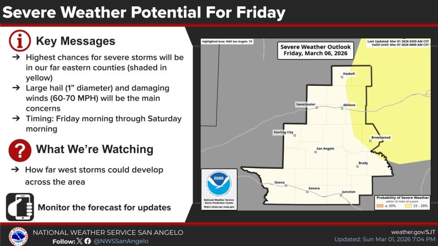
The primary threats are large hail up to 1 inch in diameter and damaging winds of 60-70 mph. The highest chances for severe storms are in eastern counties of the NWS San Angelo area, including regions around Abilene, Brownwood and Haskell, shaded in yellow on outlook maps.
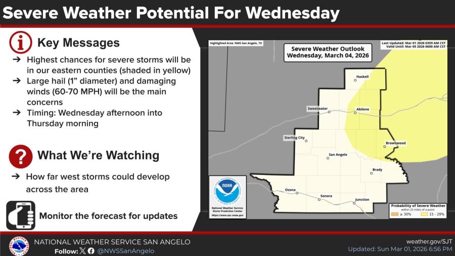
For Wednesday, March 4, 2026, severe weather is possible from the afternoon into Thursday morning, driven by a cold frontal passage and an upper-level disturbance. Forecasters are monitoring how far west storms could develop across the region.
A second round of thunderstorms is anticipated Friday, March 6, into Saturday morning, associated with another low-pressure system and cold front swinging through the southwestern U.S. The far eastern counties again face the highest severe potential.
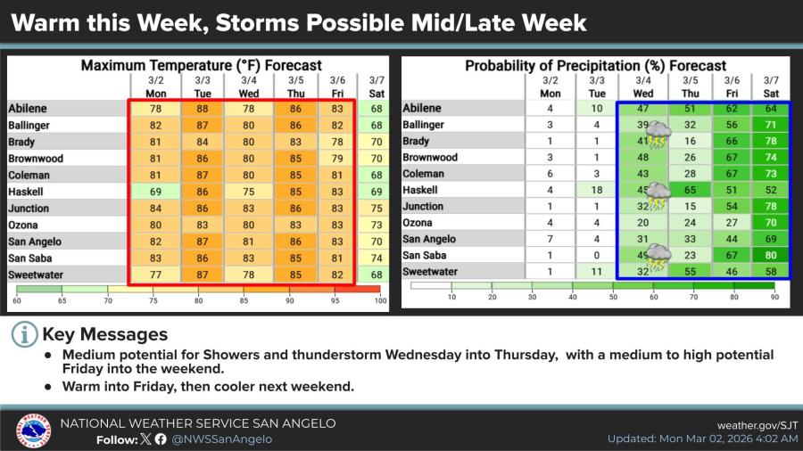
Temperatures will remain warm through Friday, with highs in the 80s across most locations — including 81-87 degrees in San Angelo, Abilene and surrounding areas Monday through Friday — before cooling this weekend.
Rain chances increase starting Tuesday and continue through the weekend, with probabilities reaching 30-70% in many areas mid- to late week.
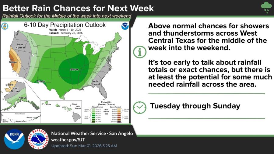
The 6-10 day outlook shows above-normal chances for showers and thunderstorms across West Central Texas from March 6-10, offering potential for much-needed rainfall, though totals remain uncertain.
No widespread severe outbreak is currently expected.


Subscribe to the LIVE! Daily

Required
Post a comment to this article here: