
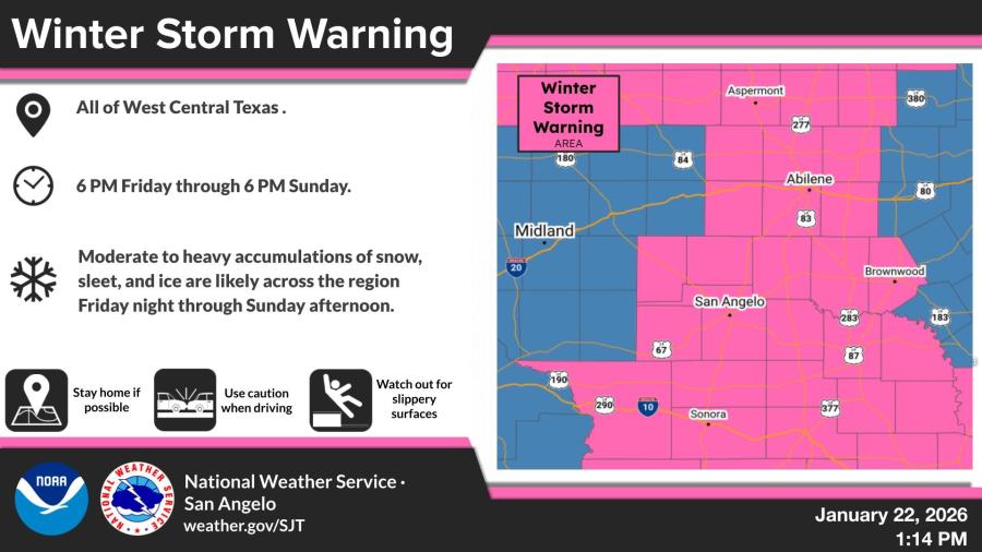
SAN ANGELO, TX — A Winter Storm Warning is in effect for all of West Central Texas from 6 p.m. Friday through 6 p.m. Sunday, with moderate to heavy accumulations of snow, sleet and ice expected, the National Weather Service said Thursday.
The warning covers the entire region, including San Angelo, Abilene, Midland and surrounding areas. Significant freezing rain, sleet and snow are forecast to begin Friday night and continue through Sunday afternoon, creating potentially hazardous travel conditions.
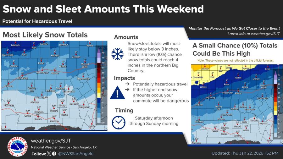
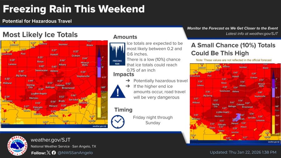
Forecasters said snow and sleet totals will most likely stay below 3 inches, with a low 10% chance of up to 4 inches in northern portions of the Big Country. Ice accumulations are expected to range from 0.2 to 0.6 inches, with a 10% chance of up to 0.75 inches.
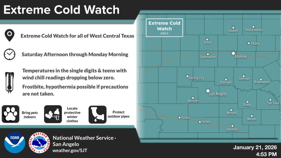
An Extreme Cold Watch also remains in effect from Saturday afternoon through Monday morning. Temperatures are forecast to drop into the single digits and teens, with wind chills falling below zero, raising risks of frostbite and hypothermia.
The weather service urged residents to stay home if possible, exercise caution while driving and watch for slippery surfaces. Additional recommendations include bringing pets indoors, wearing protective winter clothing and insulating outdoor pipes.


")
Subscribe to the LIVE! Daily

Required
Post a comment to this article here: