
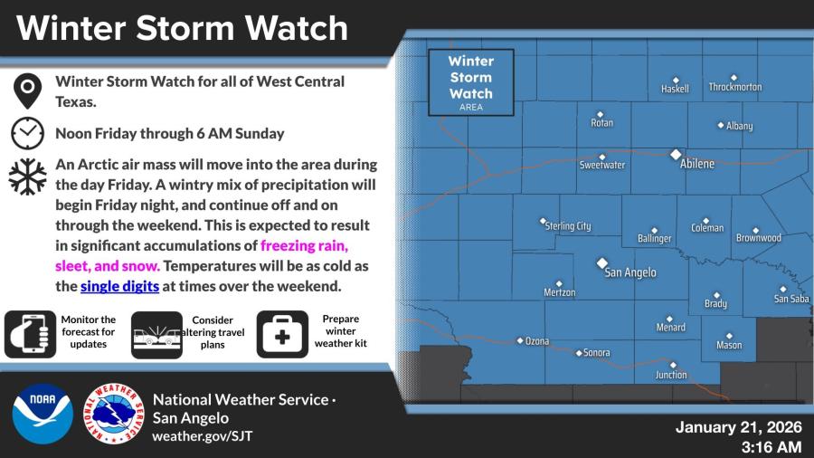
SAN ANGELO, TX — The National Weather Service in San Angelo has issued a Winter Storm Watch for all of West Central Texas from noon Friday through 6 a.m. Sunday, warning of significant accumulations of freezing rain, sleet and snow along with dangerously low temperatures.
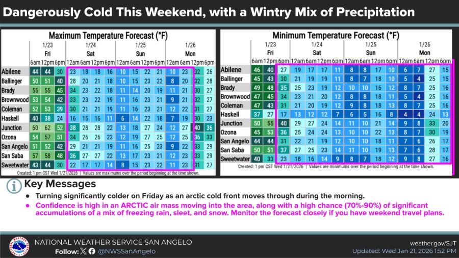
An Arctic air mass is expected to move into the region Friday, with a wintry mix of precipitation beginning Friday night and continuing through the weekend. Forecasters said temperatures could drop into the single digits at times, with wind chills falling below zero.
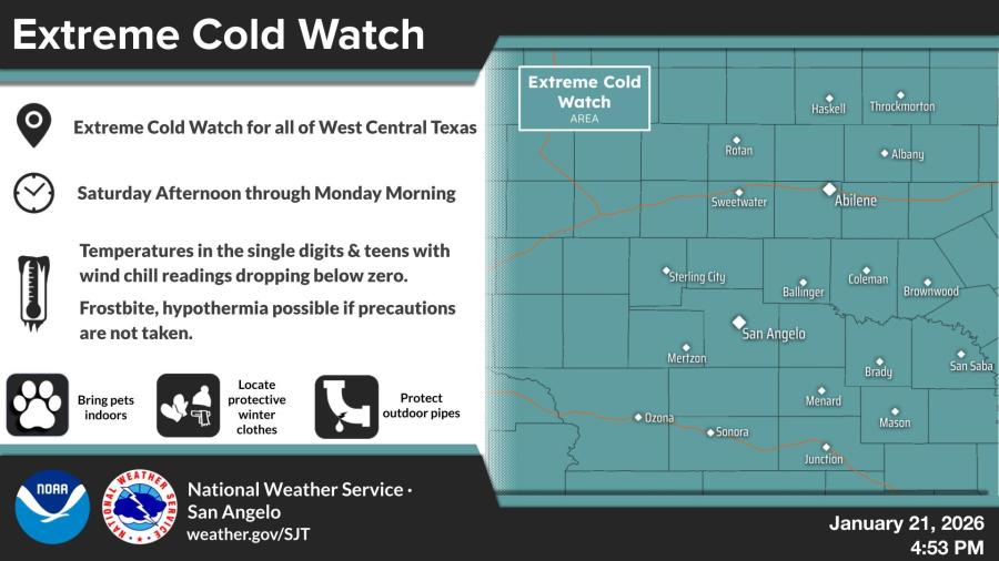
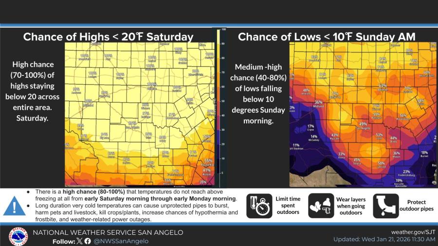
A separate Extreme Cold Watch is in effect from Saturday afternoon through Monday morning, with highs likely remaining below 20 degrees in many areas Saturday and lows potentially dipping below 10 degrees Sunday morning.
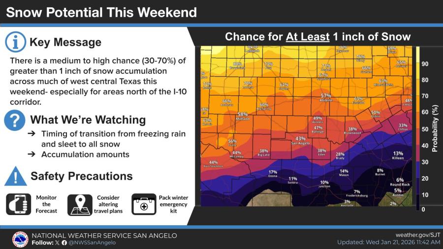
The NWS said there is a medium to high chance (30-70%) of at least 1 inch of snow accumulation, particularly north of the Interstate 10 corridor.
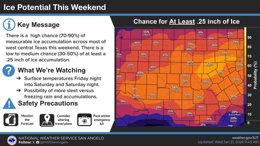
A high chance (70-90%) exists for measurable ice across most of the region, with a low to medium chance (30-50%) of at least a quarter-inch of ice accumulation, especially south of Interstate 20.
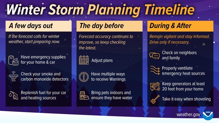
Travel impacts are likely, with icy roads possible from freezing rain and sleet. Officials urged residents to monitor forecasts, alter travel plans if necessary, prepare winter emergency kits and protect pipes, pets and plants from the prolonged cold.
In San Angelo, forecast highs are expected to fall from the upper 60s Thursday to the mid-50s Friday, with lows dropping into the teens and single digits Saturday through Monday morning.


")
Subscribe to the LIVE! Daily

Required
Post a comment to this article here: