
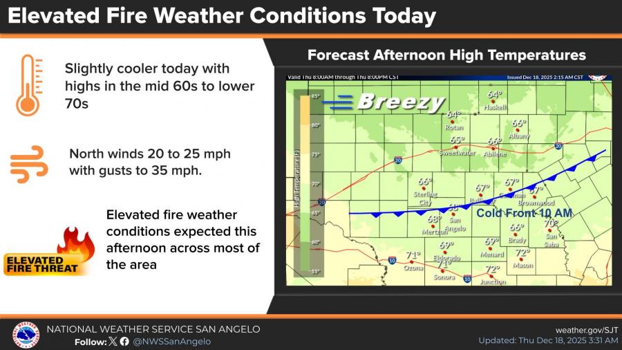
SAN ANGELO, TX — Elevated fire weather conditions are expected across much of West Central Texas on Thursday as strong north winds and low humidity follow a cold front moving through the region, according to the National Weather Service in San Angelo.
The front moved through mid to late Thursday morning, shifting winds to the north at 15 to 25 mph with gusts up to 35 mph. Afternoon highs are expected to range from the mid-60s to lower 70s, while relative humidity values fall into the upper teens and lower 20s, creating elevated fire weather conditions across most of the area.
Despite the brief cooldown, temperatures are expected to climb sharply heading into the weekend. Forecasters say a warm and dry pattern will bring well-above-normal temperatures through at least the middle of next week, with highs reaching the 80s in many locations.
In San Angelo, high temperatures are forecast to reach the mid-80s on Saturday, with a medium chance of tying or breaking daily record highs. Abilene is also forecast to reach the mid-80s Saturday, with a higher chance of setting a new record. Temperatures are expected to remain 20 to 25 degrees above normal through the weekend and into Monday.
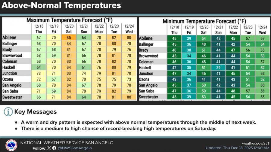
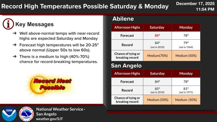
The National Weather Service indicates there is a medium to high probability, ranging from 40% to 70%, of record-breaking high temperatures on Saturday and Monday across parts of the region.
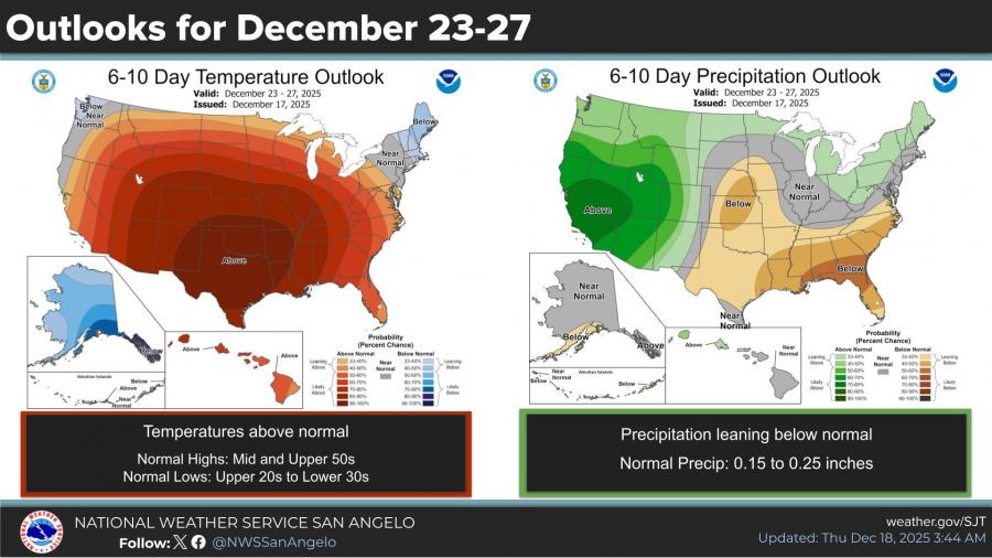
Looking ahead, the six- to 10-day outlook shows temperatures continuing to trend above normal from Dec. 23 through Dec. 27, while precipitation is expected to remain below normal. Normal highs for this time of year are in the mid to upper 50s, with normal lows in the upper 20s to lower 30s.
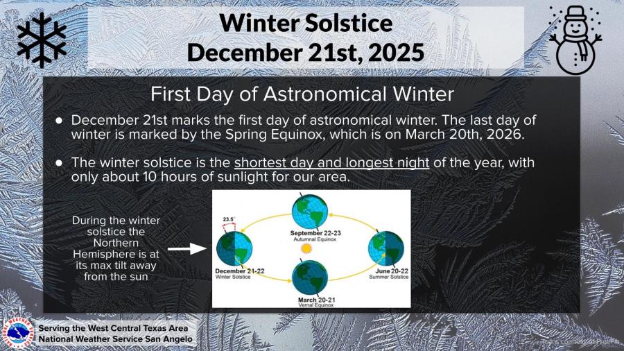
Sunday, Dec. 21, marks the winter solstice and the first day of astronomical winter. It will be the shortest day of the year, with about 10 hours of daylight across West Central Texas.
Forecasters say dry conditions combined with warm temperatures and periodic gusty winds could continue to elevate fire weather concerns in the coming days.

Subscribe to the LIVE! Daily

Required
Post a comment to this article here: