
SAN ANGELO, TX — A low-pressure system moving across West Central Texas will bring increasing chances of thunderstorms and heavy rain this weekend, with a marginal risk of severe weather Saturday and a slight risk of excessive rainfall Friday and Saturday that could produce flash flooding, the National Weather Service office in San Angelo reported.
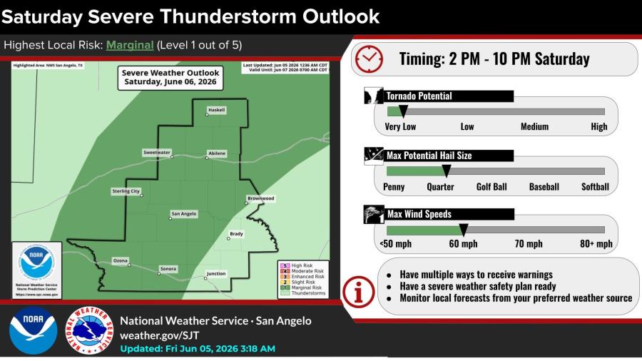
The highest local risk for severe thunderstorms Saturday is marginal, or Level 1 out of 5, according to the NWS Storm Prediction Center. Strong to severe storms are possible across much of the area between 2 p.m. and 10 p.m. Saturday. Primary threats are large hail and damaging winds. Tornado potential is very low.
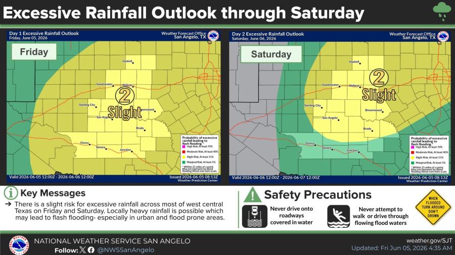
A slight risk of excessive rainfall also exists both Friday and Saturday. Locally heavy downpours could lead to flash flooding, especially in urban areas and other flood-prone spots, the NWS warned.
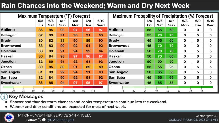
Forecast details for San Angelo show highs in the low to mid-80s Friday and Saturday, climbing to the low 90s Sunday and mid-90s early next week. Rain chances peak at 65 percent Saturday and 55 percent Sunday before dropping to near zero Monday through Wednesday as drier air moves in. Similar patterns are forecast for Abilene, Ballinger, Brownwood and other communities in the region.
The extended forecast shows temperatures rebounding into the mid- to upper 90s by early next week with minimal precipitation chances.

")

Subscribe to the LIVE! Daily

Required
Post a comment to this article here: