
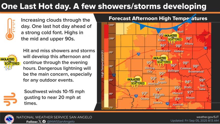
SAN ANGELO, TX — After one last hot day Friday, a strong cold front is expected to bring cooler temperatures and scattered storms to West Central Texas through the weekend, according to the National Weather Service in San Angelo.
Temperatures on Friday will climb into the mid to upper 90s, with San Angelo forecast to reach 95°F.
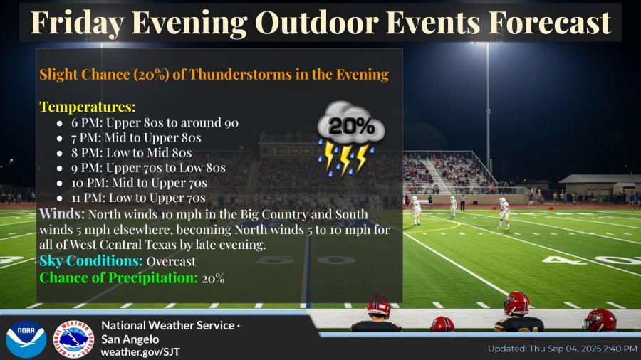
Showers and thunderstorms could develop during the afternoon and evening hours, potentially affecting outdoor events. A slight 20% chance of storms remains in place through Friday night, with overcast skies and temperatures dropping from the upper 80s at 6 p.m. to the low 70s by 11 p.m. North winds between 5 to 10 mph are expected by late evening.
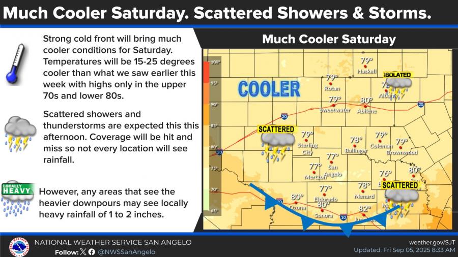
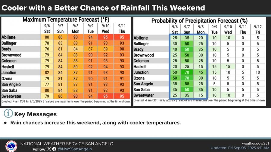
On Saturday, highs will be 15 to 25 degrees cooler, topping out in the upper 70s to low 80s. Scattered storms are expected again Saturday afternoon, with some areas possibly seeing heavy rainfall of 1 to 2 inches. Coverage will be hit or miss.
The chance of rain continues into Sunday, with San Angelo showing a 35% probability of precipitation on Saturday and a 55% chance Sunday. Temperatures will gradually warm into the upper 80s and low 90s by early next week.
Forecasters warn that lightning remains the primary concern for outdoor activities both Friday and Saturday.

")

Subscribe to the LIVE! Daily

Required
Post a comment to this article here: