
SAN ANGELO, TX — A Flood Watch remains in effect through 9 p.m. Tuesday across the Concho Valley and parts of West Central Texas, as the region faces continued threats of heavy rainfall and flash flooding, according to the National Weather Service in San Angelo.
Although widespread heavy rainfall is not expected, forecasters said the atmosphere remains moist and unstable, allowing for additional scattered showers and thunderstorms to redevelop through the early to mid-evening hours. The storms are expected to be hit or miss, meaning some locations may stay dry while others could see rapid downpours of 1 to 3 inches of rain in a short time. The saturated ground from recent rain increases the risk of flash flooding on city streets, rivers, creeks and low-water crossings.

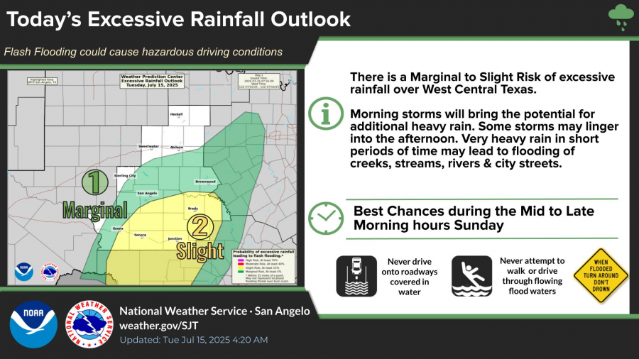
The National Weather Service highlighted a marginal to slight risk of excessive rainfall across the region, with the highest chances for flash flooding during mid to late morning hours. Officials urged drivers to avoid water-covered roadways and warned that most flood-related deaths occur in vehicles.
The forecast calls for showers and thunderstorms to continue through Tuesday afternoon before clearing skies return for the rest of the week. High temperatures are expected to climb into the upper 80s Tuesday and reach the low 90s by Thursday and Friday, with mostly sunny conditions and south winds between 5 and 10 mph.
Exercise caution in flood-prone areas.


Subscribe to the LIVE! Daily

Required
Post a comment to this article here: