
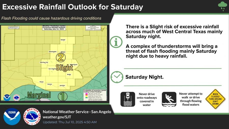
SAN ANGELO, TX — A slight risk of excessive rainfall and flash flooding is forecast across much of West Central Texas late Saturday into Sunday, according to the National Weather Service in San Angelo.
Forecasters said a complex of thunderstorms is expected to develop, bringing heavy rainfall that could create hazardous driving conditions and flash flooding, particularly Saturday night. Residents are urged to avoid driving onto water-covered roads or attempting to walk or drive through flowing floodwaters.
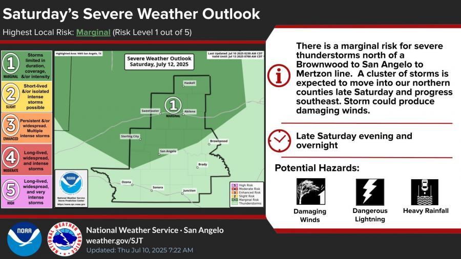
A marginal risk for severe thunderstorms is also in place for areas north of a Brownwood-to-San Angelo-to-Mertzon line Saturday night. The storms could produce damaging winds, dangerous lightning and heavy rainfall as they progress southeast.
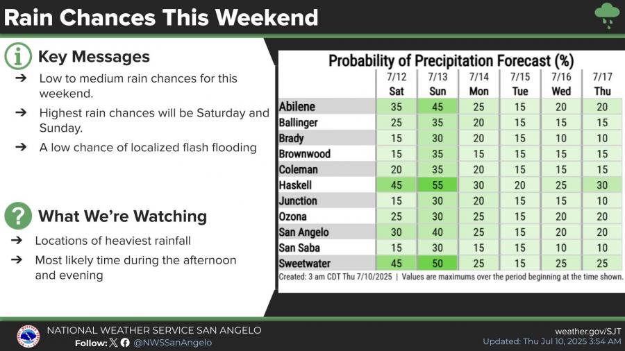
Rain chances across the region are low to medium this weekend, with the highest probabilities on Saturday and Sunday. San Angelo has a 30 percent chance of rain Saturday and a 40 percent chance Sunday. Localized flash flooding remains a possibility.
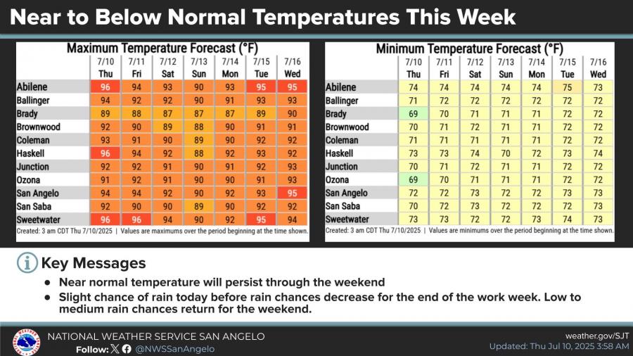
Temperatures are expected to remain near to below normal through July 16, with highs in the low to mid-90s for San Angelo and overnight lows around 72 degrees.

Subscribe to the LIVE! Daily

Required
Post a comment to this article here: