
SAN ANGELO, TX — The National Weather Service in San Angelo has issued multiple warnings for excessive rainfall and flooding across West Central Texas on Monday, citing a Marginal to Moderate risk of flash flooding that could create hazardous driving conditions.
Showers and thunderstorms are expected to redevelop through Monday evening, bringing pockets of heavy rainfall, particularly east of a line from Coleman to Junction. A Flash Flood Warning was also in effect for southern McCulloch County until 1:30 p.m. Monday, with minor flooding already reported in the area.

“Isolated to scattered showers and thunderstorms are possible again through tonight,” the National Weather Service said in its outlook. “The threat for localized heavy rainfall and flooding will continue through tonight, with the greatest threat in the Moderate Risk area.”
Areas under the Flood Watch include the Heartland, portions of the Concho Valley, Edwards Plateau, and northwest Hill Country. An additional one to three inches of rain is possible where storms develop, with some locations potentially seeing totals exceeding five inches. The Flood Watch remains in effect until 7 p.m. Monday.
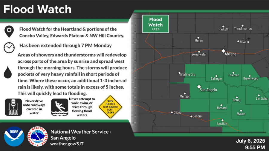
Motorists are urged not to drive onto water-covered roadways or attempt to walk, swim, or drive through flowing floodwaters. The public is advised to remember the safety slogan, “Turn Around, Don’t Drown.”
Conditions are forecast to improve by Tuesday, with mostly sunny skies expected and highs near 90 degrees. The rest of the week calls for sunny to mostly sunny conditions, with high temperatures gradually rising into the mid-90s.
For updated forecasts, visit weather.gov/SJT.


Subscribe to the LIVE! Daily

Required
Post a comment to this article here: