
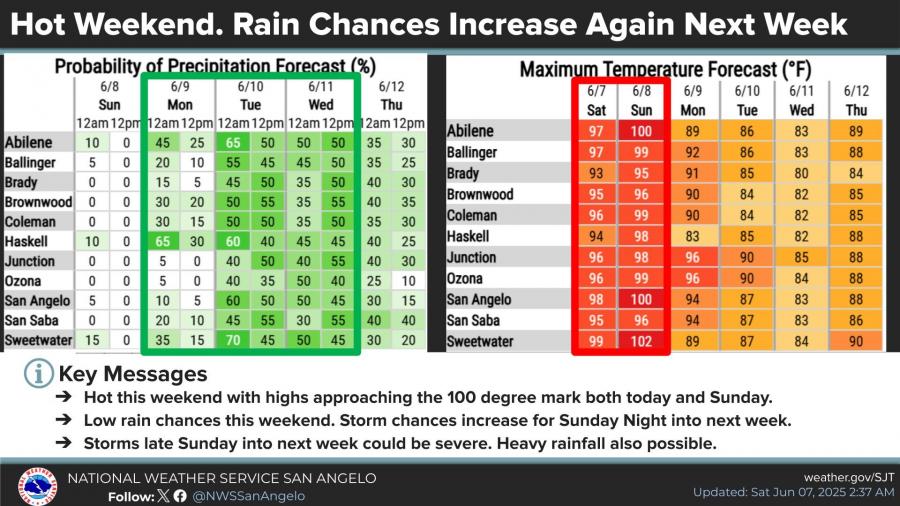
SAN ANGELO, TX — West Central Texas is experiencing a hot and dry weekend, with triple-digit temperatures expected across the region. Rain chances remain low through the weekend, but are expected to increase starting late Sunday night and continue into early next week.
The National Weather Service in San Angelo forecasts highs near or above 100 degrees Saturday and Sunday, with San Angelo expected to reach 100 on Sunday and Sweetwater topping out at 102. Despite the heat, rain is unlikely through the weekend.
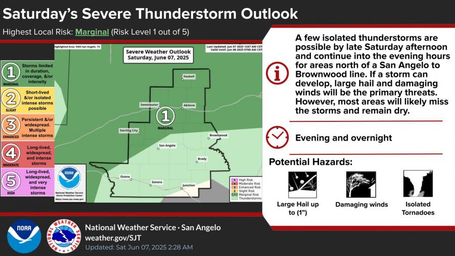
Isolated thunderstorms are possible late Saturday afternoon and evening, mainly north of a San Angelo to Brownwood line. These storms are not expected to be widespread, but could produce large hail and damaging winds if they develop.
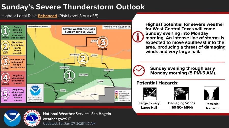
The severe weather threat increases Sunday evening as an intense line of storms moves into the area from the north. The region north of San Angelo, including Abilene and the Big Country, is under a slight and enhanced risk for severe thunderstorms. Damaging winds up to 80 mph and very large hail are the main concerns, with a possible tornado also noted.
Storm chances continue through the first half of the workweek. Rain probabilities increase by Monday, with San Angelo forecast to see a 60 percent chance of showers and storms on Tuesday. The chances stay high through Wednesday.


Subscribe to the LIVE! Daily

Required
Post a comment to this article here: