
SAN ANGELO, TX — The National Weather Service is warning of potentially severe thunderstorms, large hail, damaging winds, and flash flooding across West Central Texas, including the San Angelo area, from Monday afternoon through Tuesday morning.
A line of storms is expected to develop west of the region Monday afternoon and intensify into the evening and overnight hours. The highest risk is forecast between 4 p.m. Monday and 7 a.m. Tuesday, with a Level 3 out of 5 (Enhanced) risk for areas west of San Angelo, including Sterling City and Robert Lee.
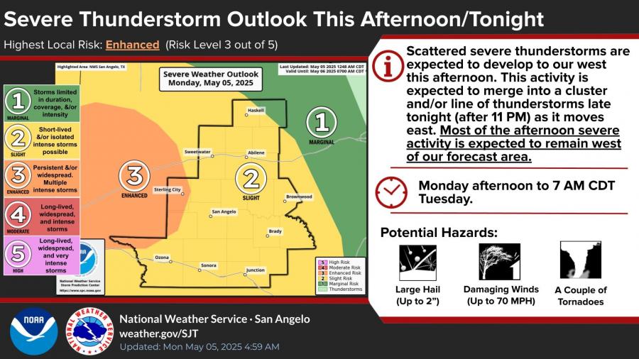
Storms may produce hail up to 2 inches in diameter, wind gusts up to 70 mph, and isolated tornadoes. While the most intense activity is expected to remain west of the San Angelo forecast area, some storms may still affect the city and surrounding counties overnight.
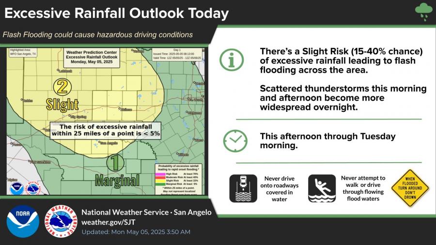
Flooding is also a concern as multiple rounds of storms could bring excessive rainfall. The Weather Prediction Center has issued a Slight Risk for flash flooding, with the heaviest rain expected along and north of I-20. Rain totals of 0.5 to 2 inches are likely, with locally higher amounts possible.
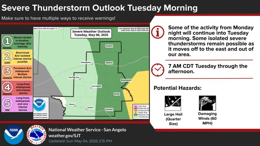
Scattered storm activity may linger into Tuesday morning as the system moves east. A Marginal Risk (Level 1 of 5) remains in effect for the San Angelo region on Tuesday.
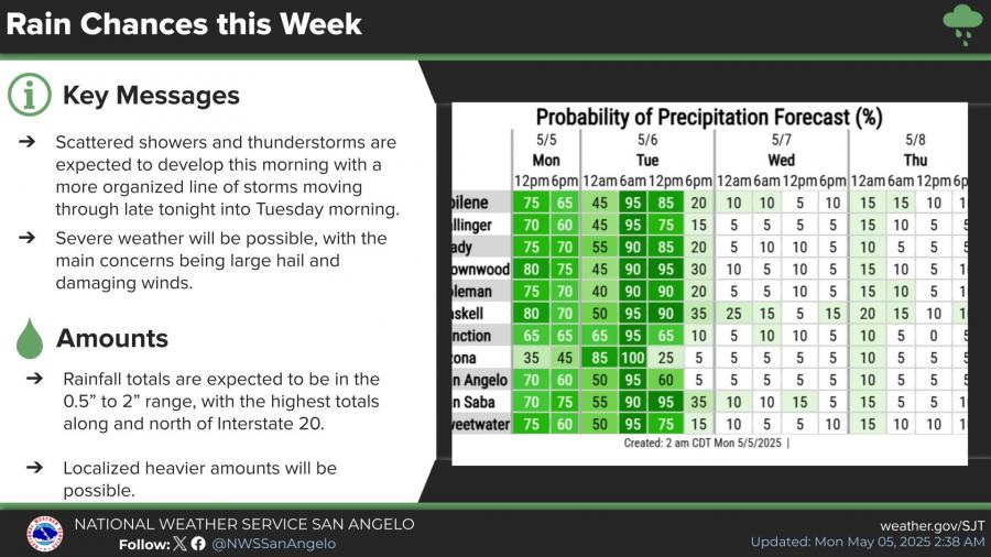
According to the National Weather Service, San Angelo faces a 95% chance of rain early Tuesday morning, with precipitation chances gradually decreasing throughout the day Tuesday. Rainfall totals are expected to range between 0.5 and 2 inches, with higher amounts possible north of Interstate 20. Localized heavier downpours could lead to flash flooding, especially in low-lying areas.
The San Angelo weather radar is currently down due to earlier storm damage, limiting real-time local tracking. The National Weather Service advises residents to have multiple ways to receive warnings and to prepare for changing conditions.

")

Subscribe to the LIVE! Daily

Required
Post a comment to this article here: