
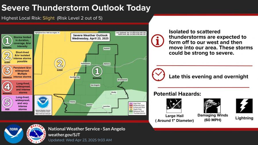
SAN ANGELO, TX — Scattered strong to severe thunderstorms are expected to develop west of San Angelo this afternoon, with some storms likely to reach the Concho Valley area by this evening and continue overnight, according to the National Weather Service.
While the highest severe weather threat remains to the west, forecasters say a few storms in the San Angelo region could still produce large hail up to 1 inch in diameter, damaging winds up to 60 mph, and frequent lightning. The area is under a “Slight Risk” (Level 2 of 5) for severe weather.
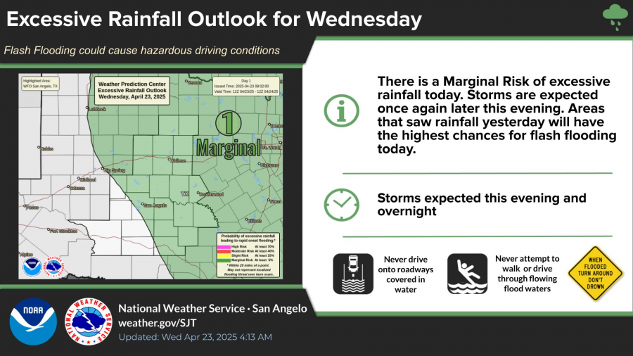
In addition to the severe storm potential, the region also faces a “Marginal Risk” for excessive rainfall, especially in locations that received heavy rain on Tuesday. Flash flooding could pose hazardous driving conditions during the overnight hours.
“Isolated to scattered thunderstorms are expected to form off to our west and then move into our area. These storms could be strong to severe,” the NWS stated in its morning outlook.
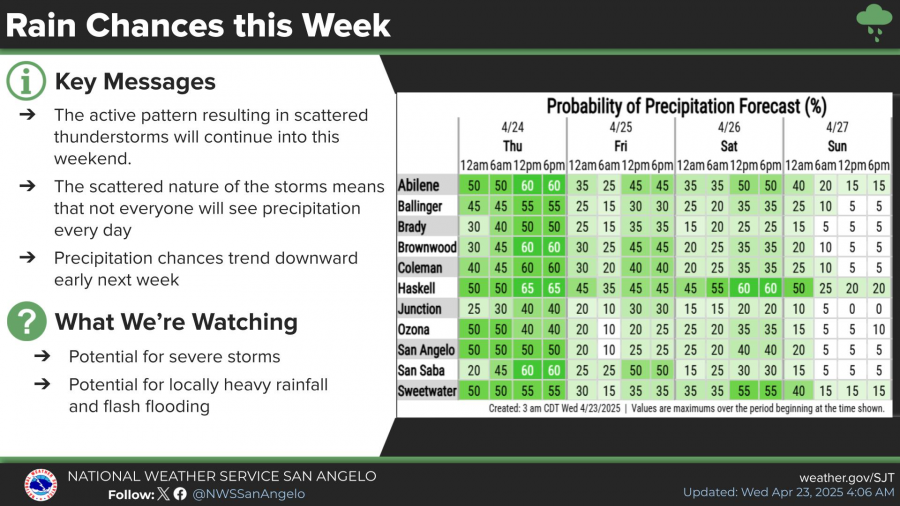
Rain chances remain elevated throughout the week with an active weather pattern expected to continue into the weekend. While not all areas will see rainfall each day, forecasters are monitoring for the potential of additional severe storms and locally heavy rainfall through Saturday. Precipitation chances are forecast to decrease early next week.

Subscribe to the LIVE! Daily

Required
Post a comment to this article here: