
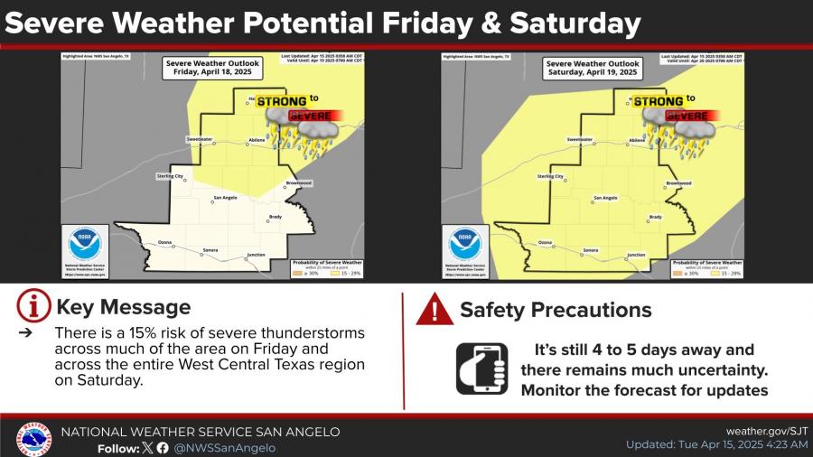
SAN ANGELO, TX — The National Weather Service is warning of multiple rounds of showers and potentially severe thunderstorms expected to impact West Central Texas from Friday night through late Saturday night, with risks continuing into early Sunday morning.
There is a 15% risk of severe thunderstorms across much of the region on Friday, with the threat expanding to include the entire area on Saturday. Some of these storms may become strong to severe, bringing hazards such as hail, damaging winds and locally heavy rainfall.
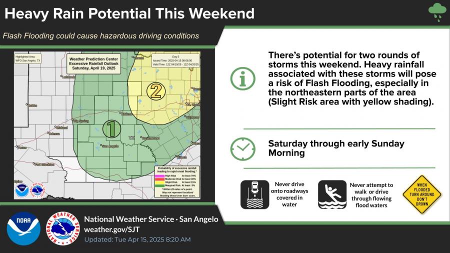
Meteorologists are also monitoring the potential for flash flooding. The northeastern portions of the area face a slight risk of excessive rainfall, with forecasts indicating two distinct rounds of storms that could lead to hazardous driving conditions.
Rainfall totals of at least 0.5 inches are expected across a wide area, with the highest probabilities east of San Angelo and in the eastern Big Country. There is a 61% chance of at least half an inch of rain in San Angelo from Friday evening through Monday morning.
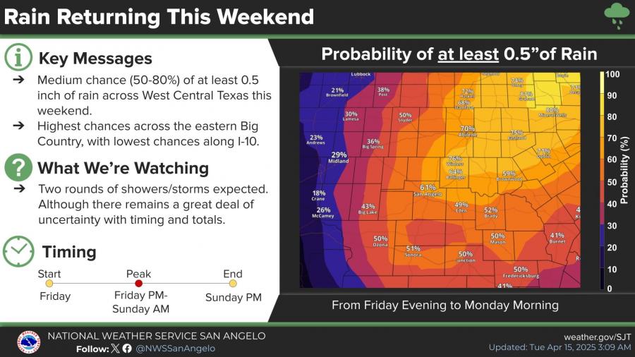
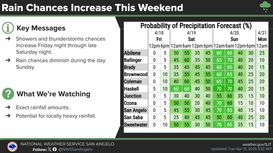
The rain and storm activity is expected to peak between Friday evening and Sunday morning, then diminish through the day Sunday. Rain chances are currently forecast at 70% for San Angelo during the early hours of Sunday.
The National Weather Service stated that the forecast still carries some uncertainty, and conditions may change as the weekend approaches.


Subscribe to the LIVE! Daily

Required
Post a comment to this article here: