
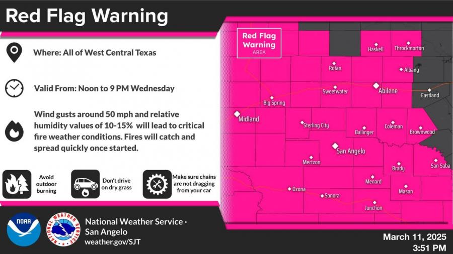
SAN ANGELO – The National Weather Service has issued a Red Flag Warning for all of West Central Texas until 9 p.m. Wednesday, as strong winds and low humidity create critical to extremely critical fire weather conditions.
Wind gusts are expected to reach 50 mph, with relative humidity levels dropping to 10-15%, increasing the risk of fast-spreading wildfires. Residents are urged to avoid outdoor burning, refrain from driving on dry grass, and ensure that chains are not dragging from vehicles.
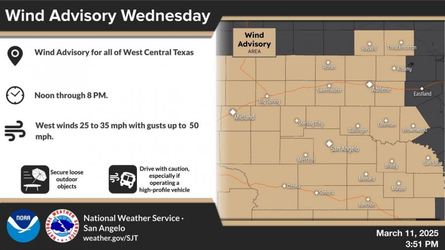
A Wind Advisory is also in effect until 8 p.m. Wednesday, with sustained west winds of 25-35 mph and gusts up to 50 mph. The NWS advises securing loose outdoor objects and exercising caution while driving, especially for high-profile vehicles.
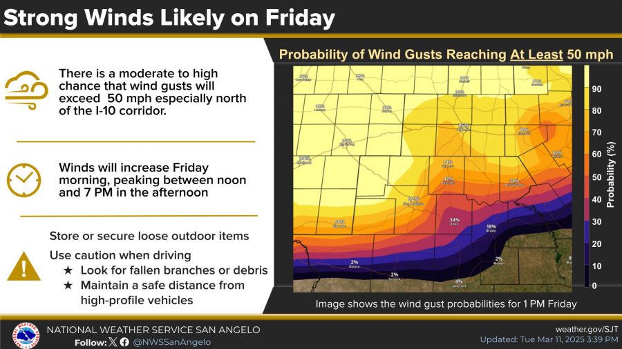
Stronger winds are expected Friday, with a moderate to high probability of gusts exceeding 50 mph, mainly north of the I-10 corridor. The strongest winds will occur between noon and 7 p.m., raising the potential for extreme fire danger in areas north of a San Angelo to Brownwood line, where humidity levels are expected to fall below 15%.

In addition, temperatures are forecast to remain in the 80s through Thursday before a cold front arrives Friday and Saturday, bringing slightly cooler temperatures.


Subscribe to the LIVE! Daily

Required
Post a comment to this article here: