
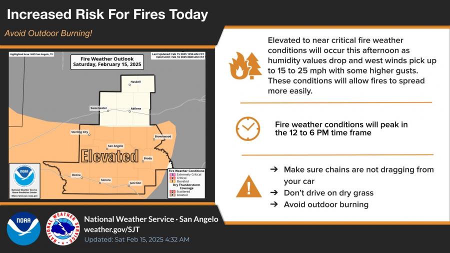
SAN ANGELO – West Central Texas could see record-breaking cold temperatures midweek, but first, an elevated fire danger is in effect today.
The National Weather Service warns that gusty west winds of 15 to 25 mph and low humidity levels will create an increased risk of wildfires this afternoon. Fire conditions are expected to peak between noon and 6 p.m., and residents are urged to avoid outdoor burning, ensure vehicle chains are not dragging, and stay off dry grass.
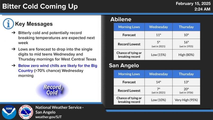
A bitter cold front will arrive Tuesday night, bringing the potential for record-breaking low temperatures on Wednesday and Thursday mornings.
In San Angelo, temperatures are forecast to drop to 14°F on Wednesday and 13°F on Thursday. There is a 95% chance of breaking Thursday’s record low of 20°F, set in 1936. In Abilene, temperatures could fall to 11°F on Wednesday and 10°F on Thursday, with an 80% chance of breaking the 1955 record of 16°F.
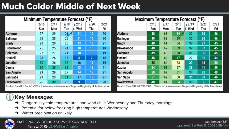
The cold front will push high temperatures near or below freezing on Wednesday, though winter precipitation is unlikely.


Subscribe to the LIVE! Daily

Required
Post a comment to this article here: