
SAN ANGELO, TX – A cold front has pushed through the region, bringing cooler temperatures and increased chances of rain through midweek.
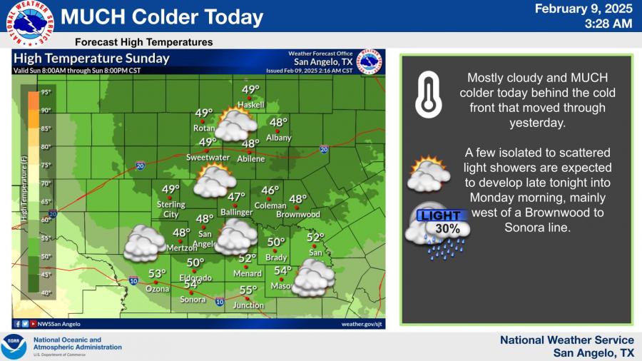
According to the National Weather Service, Sunday's highs will be 25 to 35 degrees lower than Saturday's, with widespread cloud cover and breezy north winds. Temperatures will struggle to climb out of the 40s and low 50s across the area.
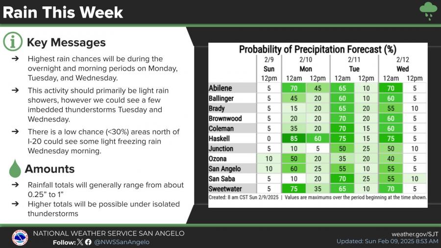
Rain chances will increase overnight Sunday into Monday, with intermittent showers expected through Wednesday. The highest precipitation probabilities will be in the morning and overnight hours, with the possibility of embedded thunderstorms on Tuesday and Wednesday. Rainfall amounts are generally expected to range between 0.25 and 1 inch, with localized higher totals under stronger storms.
While most of the precipitation will be rain, forecasters note a low chance of light freezing rain north of I-20 early Wednesday morning.
Temperatures will remain cool throughout the week, with the coldest morning expected Thursday, when lows could drop into the low 20s in some locations. High temperatures are forecast to gradually rise after midweek but will remain below seasonal averages.


")
Subscribe to the LIVE! Daily

Required
Post a comment to this article here: