
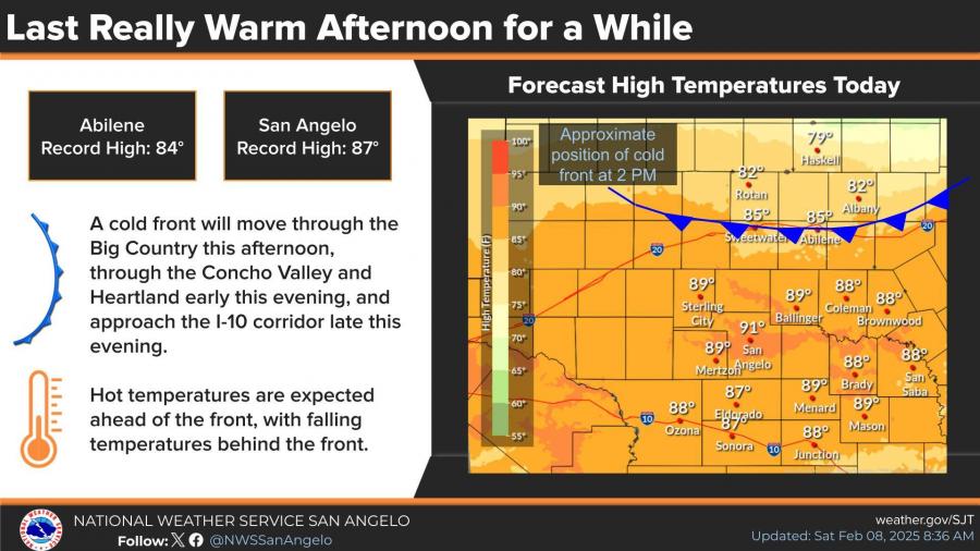
SAN ANGELO, TX — Saturday marks the last warm afternoon for at least a week as a cold front moves through, bringing a drop in temperatures and increasing rain chances into early next week, according to the National Weather Service.
San Angelo and Abilene are expected to reach near-record highs Saturday, with temperatures soaring into the upper 80s and low 90s ahead of the front. By the evening, the front will push through the Big Country and Concho Valley, bringing gusty winds and cooler temperatures.
Rain chances increase Monday through Wednesday, with the highest likelihood of precipitation on Tuesday. While most of the rainfall is expected to be liquid, there is a low chance (less than 30%) of freezing rain developing north of Interstate 20 by Tuesday night.
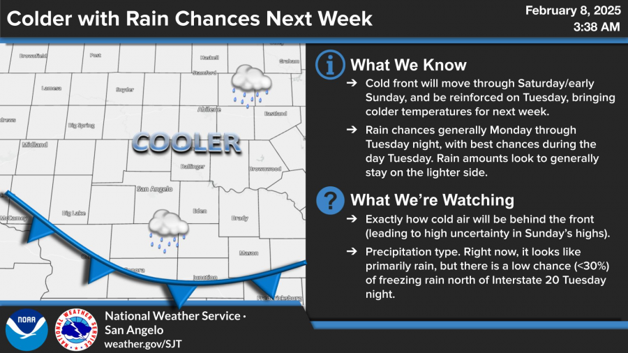
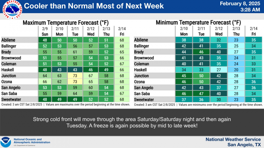
A secondary cold front arriving Tuesday will reinforce the chill, keeping temperatures below normal for much of next week. San Angelo’s high temperatures will drop into the low 50s by midweek, with overnight lows dipping into the mid-30s. A freeze is possible later in the week.
Forecasters continue to monitor the potential for winter precipitation.


")
Subscribe to the LIVE! Daily

Required
Comments
“Saturday marks the last day for warm weather for at least a week”.
Really? Then why does next Friday and Saturday have highs near 70? Where I went to school, 5 to 6 days is shorter than one week.
“Last Really Warm Afternoon For a While”. There’s so much wrong with this headline, I will not touch this one.
”The rainfall is expected to be liquid”. Well I’ll be damned, I expected rainfall to be a solid or a gas. Not liquid!
”Temps will drop into the 50s by midweek”. Wow! What a drastic change from forecast highs in the low 50s Sunday -Tuesday.
Lucas has written 3 weather stories in 3 days. Maybe the third time isn’t always a charm….
- Log in or register to post comments
PermalinkPost a comment to this article here: