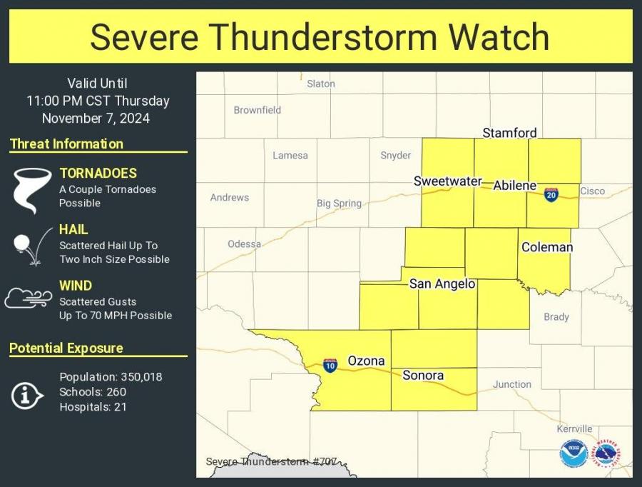
SAN ANGELO, TX — A severe thunderstorm watch is in effect for San Angelo and surrounding areas in West Central Texas until 11 p.m. Thursday, the National Weather Service Abilene/San Angelo announced.
Residents are urged to watch for potential large hail, damaging winds, and heavy rainfall.
National Weather Service
National Weather Service
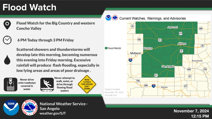
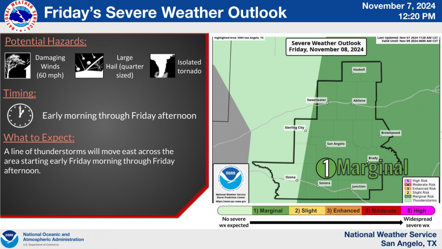
As of 5:30 p.m., thunderstorms have begun developing in western portions of the Concho Valley, with storm activity expected to increase in coverage over the evening. The main concerns include strong gusty winds, large hail up to two inches in diameter, and locally heavy rainfall that could lead to flash flooding in low-lying areas.
The NWS also warned of the potential for isolated tornadoes. The storm system is expected to continue through early Friday afternoon, bringing a line of thunderstorms across much of the region, with the heaviest rainfall anticipated tonight through Friday morning.
National Weather Service
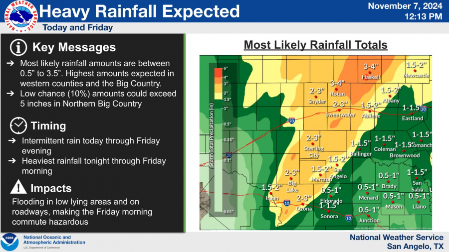
Rainfall totals are projected to reach between 0.5 and 3.5 inches, with the highest amounts likely in western counties and the Big Country. There is a low chance that some areas in the northern Big Country could see up to 5 inches of rain, increasing the risk of localized flooding.
National Weather Service
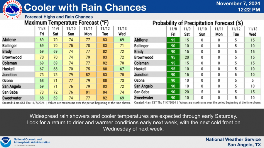
Cooler temperatures and widespread rain showers are anticipated to persist through early Saturday, with drier and warmer conditions forecasted to return early next week. Another cold front is expected to arrive by Wednesday, bringing additional cooler weather.
National Weather Service
The NWS encourages residents to report any instances of hail or wind damage, noting the time and location.
UPDATE: The National Weather Service in Abilene/San Angelo reported an 8 p.m. update that additional storms have developed over the western Concho Valley, stretching southwestward to the Edwards Plateau. These storms may bring gusty winds and heavy rain to San Angelo between 8 and 9 p.m. Meanwhile, storms further northeast along the I-20 corridor, moving southward toward Coleman County, could still be producing large hail as they push eastward.
Subscribe to the LIVE! Daily
Required




Post a comment to this article here: