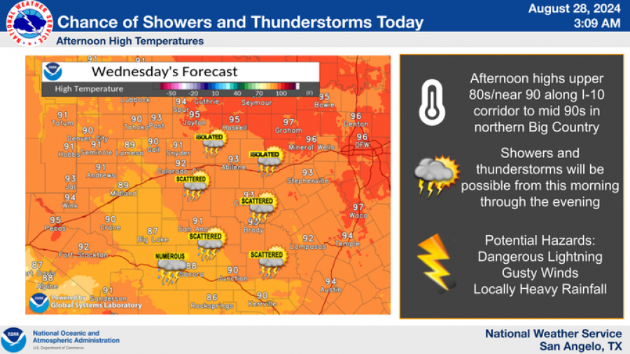
SAN ANGELO, TX - Severe weather conditions are impacting San Angelo and surrounding areas as thunderstorms sweep across the region, bringing heavy rainfall, dangerous lightning, and strong winds.
According to the National Weather Service in Abilene/San Angelo, multiple rounds of thunderstorms where expected throughout the day, affecting areas including the Concho Valley, Northern Edwards Plateau, and western Big Country. The storms are predicted to produce hazardous conditions, with the potential for localized flooding and brief, heavy rainfall.
National Weather Service
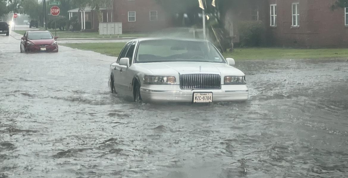
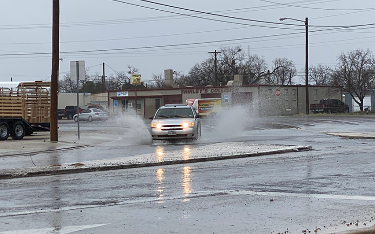
The San Angelo Police Department issued an advisory warning residents of flooding on the southwest side of the city, particularly around Sul Ross and Sunset areas. Drivers are urged to exercise caution and avoid driving through flooded roads. “Turn Around, Don’t Drown,” the advisory stated.
National Weather Service
National Weather Service
The NWS also provided a detailed forecast for the coming days, indicating a 50% chance of showers and thunderstorms this afternoon, with decreasing probabilities overnight.
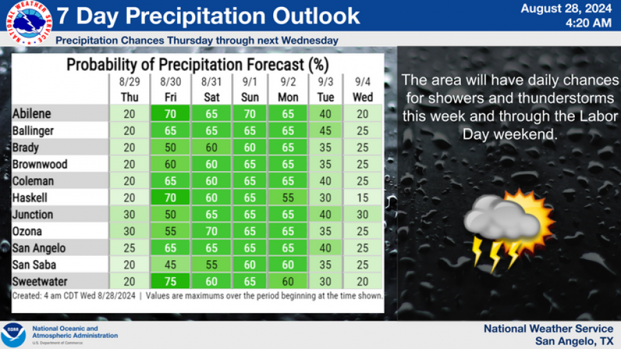
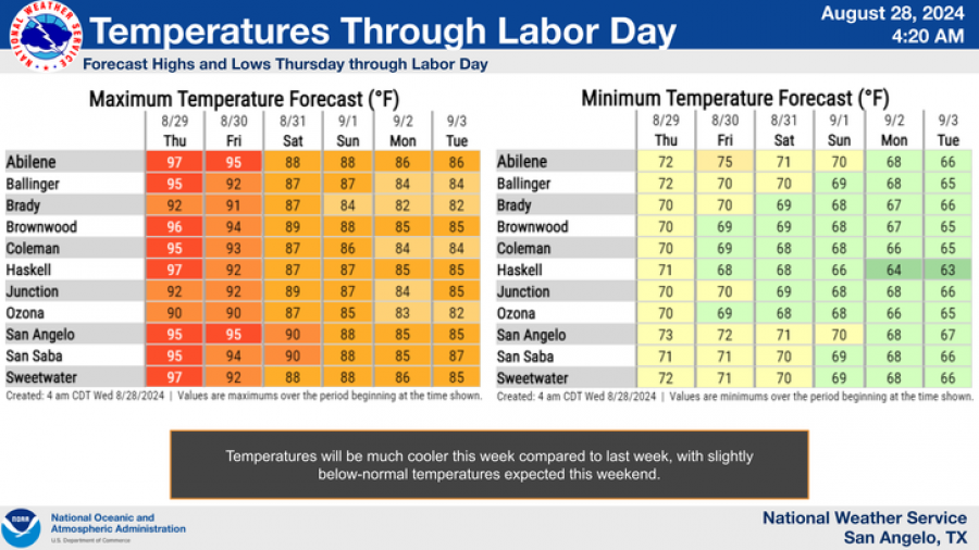
Additional chances of storms are forecasted through the rest of the week, with slightly cooler temperatures expected by Labor Day weekend. The NWS highlights that the area will have daily chances for showers and thunderstorms through next Wednesday.
Subscribe to the LIVE! Daily
Required



Post a comment to this article here: