
SAN ANGELO, TX – Rain chances and fluctuating temperatures will affect the region through midweek, with a sharp drop in temperatures expected by Thursday morning.
According to the National Weather Service in San Angelo, the highest rain chances will occur Monday night into Tuesday morning, with another round expected Tuesday night before tapering off by Wednesday morning. While precipitation is expected to be light, isolated thunderstorms could develop Monday night into early Tuesday.
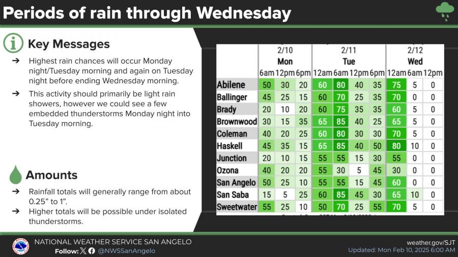
Rainfall totals are projected to range from 0.25 to 1 inch, with locally higher amounts possible in thunderstorms. Forecasters are also monitoring the potential for freezing rain north of Interstate 20, though the likelihood remains low.
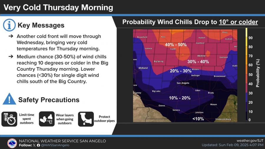
The main cold air event will arrive by Wednesday night, bringing very cold temperatures Thursday morning. Wind chills could drop to 10 degrees or colder in parts of the Big Country, with the highest probability in areas north of San Angelo. Forecast lows for San Angelo on Thursday morning are in the mid-20s, with wind chills in the teens.
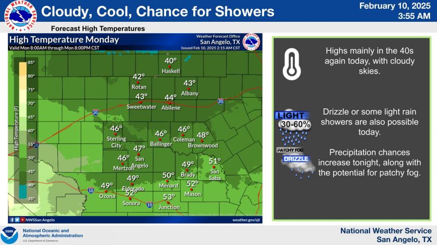
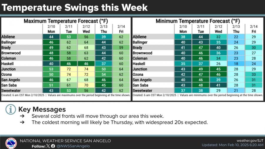
High temperatures will fluctuate throughout the week, ranging from the upper 40s on Monday to the upper 60s on Wednesday before another sharp drop to the low 40s on Thursday.

")

Subscribe to the LIVE! Daily

Required
Comments
Listed By: Rita Repulsa
Nice to be able to talk about the weather instead of Ye's Nazi and Hitler comments. The guy is just an amazing musical genius. Best rapper ever.
Anyway, be on the lookout!
- Log in or register to post comments
PermalinkPost a comment to this article here: