
SAN ANGELO, TX – Critical fire weather conditions are expected to develop across West Central Texas early next week, with the highest risk occurring Tuesday.
The National Weather Service in San Angelo warns that elevated fire danger will begin Sunday, urging residents to avoid outdoor burning and take precautions against accidental ignitions.
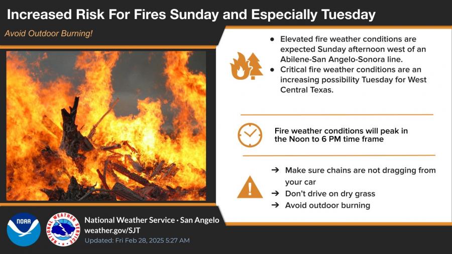
According to the forecast, fire weather conditions will peak between noon and 6 p.m. on both Sunday and Tuesday. Strong gusty winds, combined with dry air moving in from the west, are expected to increase the threat of wildfires. Residents are advised to ensure safety chains are not dragging from vehicles, avoid driving on dry grass, and refrain from outdoor burning.
In addition to the fire risk, above-normal temperatures are forecast for the region. San Angelo is expected to reach a high of 83 degrees on Monday before temperatures drop into the 70s later in the week. The forecast also indicates a low chance of showers Sunday, with a moderate chance for rain Monday night.

Tuesday is projected to be very windy, with blowing dust possible, further contributing to hazardous fire conditions. The National Weather Service will continue monitoring the situation and provide updates as needed.


")
Subscribe to the LIVE! Daily

Required
Post a comment to this article here: