
SAN ANGELO, TX – A cold front will push through West Texas on Tuesday, bringing rain, fog, and a temperature drop.
The National Weather Service in San Angelo reports that morning drizzle and showers will clear by noon, with cloudy conditions lingering into the afternoon.
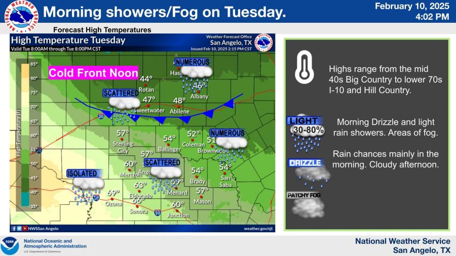
High temperatures on Tuesday will vary widely, ranging from the mid-40s in the Big Country to the low 70s near the I-10 corridor and Hill Country.
The cold front is expected to reach the Big Country by the morning but weaken as it moves southward into the Concho Valley and Heartland.
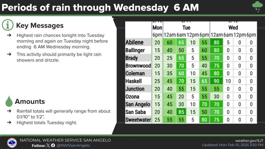
Rain chances will increase starting tonight, with intermittent chances through Tuesday night. Light rain is expected tonight and Tuesday morning, 1/10 inch or less. Up to 1/4 inch possible Tuesday night.
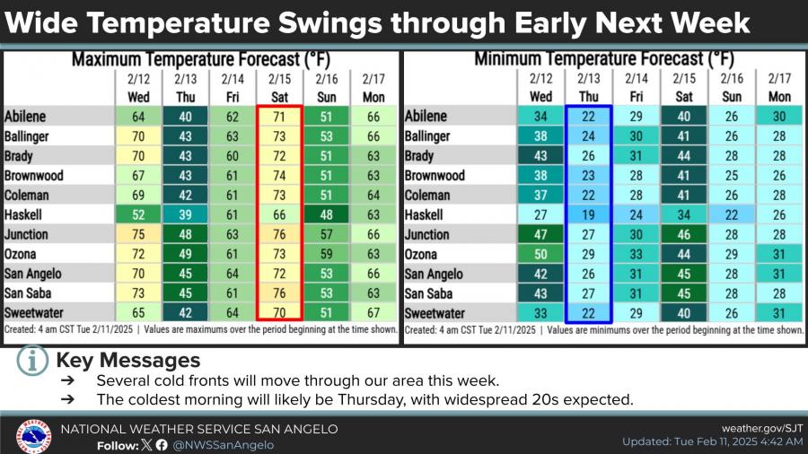
Additional cold fronts will sweep through the region throughout the week, leading to sharp temperature fluctuations.
The coldest morning is forecast for Thursday, with widespread lows in the 20s and wind chills between 10 and 20 degrees. Highs will rebound by the weekend, with temperatures reaching the 70s before another cooldown early next week.

")

Subscribe to the LIVE! Daily

Required
Post a comment to this article here: