
MATAGORDA, TX – Hurricane Beryl has been downgraded to a tropical storm, according to the National Hurricane Center. Despite the downgrade, severe weather conditions continue to impact Southeast Texas.

Residents needing evacuation assistance can register with the State of Texas Emergency Assistance Registry (STEAR). This free service helps local emergency planners and responders by providing information on the community’s needs. However, registration does not guarantee specific services during an emergency. The registry is particularly aimed at people with disabilities, medical needs, or those requiring transportation or personal care assistance. Register online or by calling 211.
Officials have called for voluntary evacuations in parts of Galveston, Matagorda, and Brazoria counties. A mandatory evacuation order was issued Sunday afternoon for the Town of Quintana.
Evacuations in Matagorda County apply to coastal areas, including Sargent, Matagorda, and Palacios.
The Latest on Beryl’s Approach to Texas
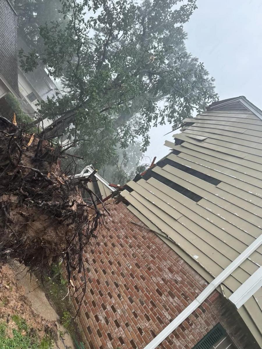
Hurricane Beryl made landfall on the Gulf Coast of Texas early today near the coastal town of Matagorda, about 85 miles south-southwest of Houston, packing maximum sustained winds of 80 mph. The National Hurricane Center reported that “life-threatening storm surge, damaging wind gusts, and flooding rainfall” continue to batter southeastern Texas.
Tragically, two people died in Harris County, Texas, after trees fell on their homes. The storm has claimed the lives of at least 11 people over the past week in Venezuela, Jamaica, Grenada, St. Vincent and the Grenadines, and now Texas. More than 2.5 million customers are currently without power.
Beryl weakened to a tropical storm after causing havoc in the Caribbean and Mexico’s Yucatán Peninsula but strengthened yesterday from the hot water of the Gulf of Mexico.
Severe Weather Conditions Expected
The worst of the storm is anticipated from now until 2 p.m. Conditions at the coast will deteriorate rapidly after midnight. The City of Houston and surrounding areas should brace for the most significant impacts from rain and wind until 2 p.m. Tropical storm-force winds of up to 70 mph are expected in Houston by midday, with higher gusts near 90 mph possible along the coast during landfall.
Active Weather Alerts
- A Flash Flood Warning is in effect for Montgomery, Chambers, Galveston, Liberty, and San Jacinto counties until noon.
- A Tropical Storm Warning remains in effect for Austin, Brazoria, Colorado, Fort Bend, Galveston, Grimes, Harris, Jackson, Liberty, Matagorda, Montgomery, Polk, San Jacinto, Walker, Waller, Washington, and Wharton counties until 6:15 p.m.
- A Flash Flood Warning is in effect for the area around Halls Bayou at Airline Drive until further notice.
- Storm Surge Warnings are in effect for the entire upper Texas coast, including Galveston. Water rises of up to 7 feet are possible along coastal areas, with Galveston potentially seeing up to 6 feet of storm surge, including Galveston Bay.


Impact and Safety Precautions
The storm’s most severe impacts include heavy rainfall causing localized flooding, tropical storm to near hurricane-force winds, coastal inundation from storm surge and elevated tides, strong rip currents, and brief tornadoes. More than 120 Texas counties, including Harris, Fort Bend, Galveston, Brazoria, and Montgomery, are under a disaster declaration.
911 Usage Reminder
The Greater Harris County 911 Emergency Network urges residents to only use 911 for life-threatening emergencies. Non-emergency calls can delay critical responses and overload call centers, especially during severe weather.
Airport Updates
Some flights out of Houston have been canceled. Houston Airports COO Kelly Woodward stated that flight operations will be assessed throughout the morning. Bush Airport temporarily closed Terminal B, with United Airlines operating out of Terminal C. TSA checkpoints remain open at Terminals A and C, with reduced capacity at Terminal D.


")
Subscribe to the LIVE! Daily

Required
Post a comment to this article here: