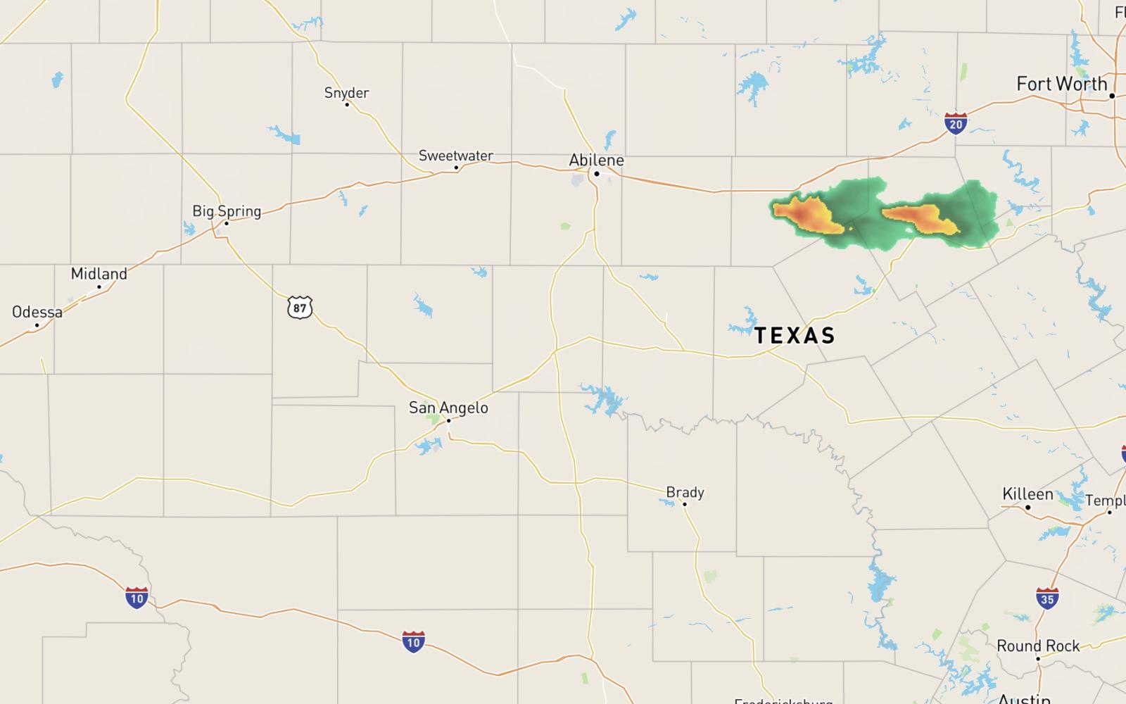
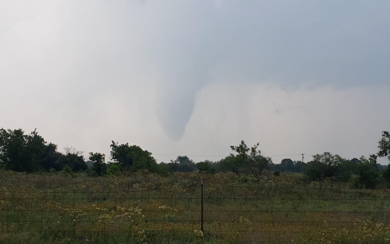
SAN ANGELO, TX — A massive thunderstorm line developed south of Abilene and kicked up at least one tornado near Cross Plains late Saturday afternoon, May 25.
While San Angelo and the Concho Valley were identified in a tornado watch earlier today, forecasters at the San Angelo National Weather Service do not believe severe weather will hit this area before the watch expires at 9 p.m. CDT tonight.
Forecasters are watching a weak disturbance aloft as it interacts with the westward retreating dryline tonight. This could instigate rain showers in the Concho Valley at 11 p.m. However, there is only a small chance of this happening.
The radar picture for the Concho Valley is currently clear of all moisture events or buildups.
At around 6 p.m. a line of thunderstorms with maximum tops of 70,000 feet MSL traversed through Cross Plains and Coleman County. That line continues to move northeasterly and is just now crossing through Eastland, Cisco and along I-20 north of Brownwood. The line stretches to Stephenville. This was the line of storms that spawned at least one tornado in a rural area. We do not have damage reports that would indicate it touched down.
In summary, rain showers in and around San Angelo are possible tonight but not likely. The weather radar is clear west of the Concho Valley. Although a weak disturbance is interacting with the westward retreating dryline that could cause wet weather tonight.

Weather Radar as of 7:28 p.m. on May 25, 2024

A tornado spotted near Cross Plains and photographed by Jeff Frame (via X)
Subscribe to the LIVE! Daily
Required


Post a comment to this article here: