
SAN ANGELO, TX — A Flood Watch goes into effect at 6 p.m. Sunday, with forecasters warning of heavy rainfall, flooding, and a slight risk of severe thunderstorms across San Angelo and West Central Texas through Monday morning, according to the National Weather Service.
Rain chances are 70–90% today and tonight, with 0.5 to 2 inches expected and localized higher totals possible. With saturated soils already in place, even moderate rainfall may cause flooding in low-lying and urban areas, the Weather Service said.

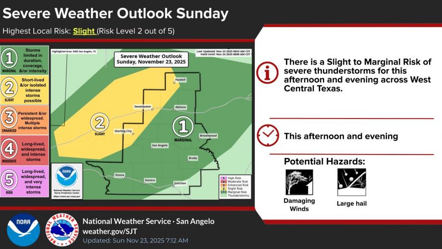
A Slight to Marginal Risk (Level 1–2 of 5) for severe storms is also in place this afternoon and evening. Large hail, damaging winds, and heavy downpours are the primary hazards.
Storm coverage will increase late today, with the heaviest rainfall expected overnight into early Monday. Rain chances taper off through mid-morning Monday, followed by gradual clearing.
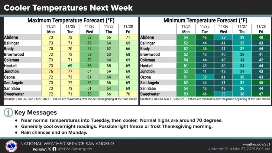
Temperatures will remain near normal early this week before turning cooler midweek. A light freeze or frost is possible Thanksgiving morning in parts of the region.


")
Subscribe to the LIVE! Daily

Required
Comments
Listed By: Wiley Coyote
Needs to rain out west. We need a livestock killing flood in our water shed areas to fill our lakes!!!
- Log in or register to post comments
PermalinkPost a comment to this article here: