
SAN ANGELO, Texas — The National Weather Service says rain and thunderstorm chances will increase by midweek across West Central Texas, with a slight risk for excessive rainfall that could lead to flash flooding from Wednesday night through Thursday morning.
Forecasters report rain chances between 70% and 80% as a disturbance develops over the region. A frontal passage on Thursday is expected to support heavier rainfall, with forecast totals ranging from 1 to 2 inches in some areas.
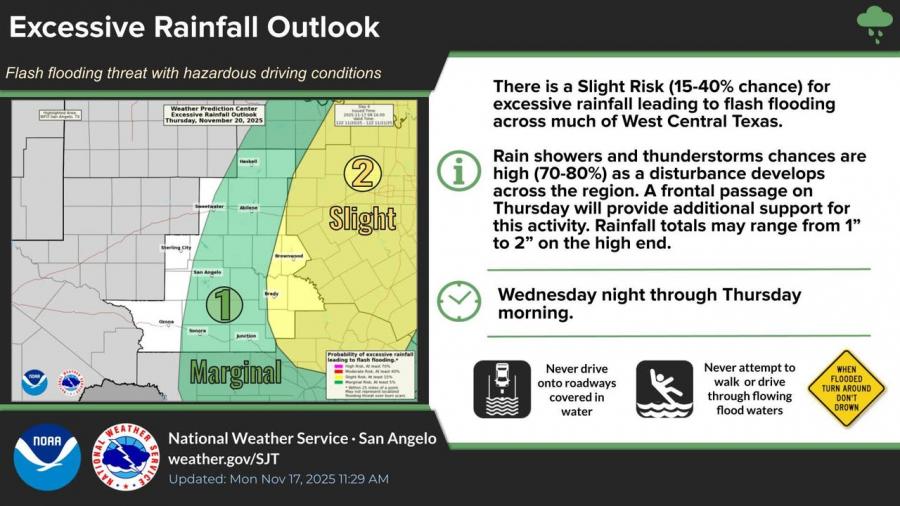
The Weather Prediction Center has placed portions of the region under a Slight Risk (15–40%) for excessive rainfall, mainly east of San Angelo.
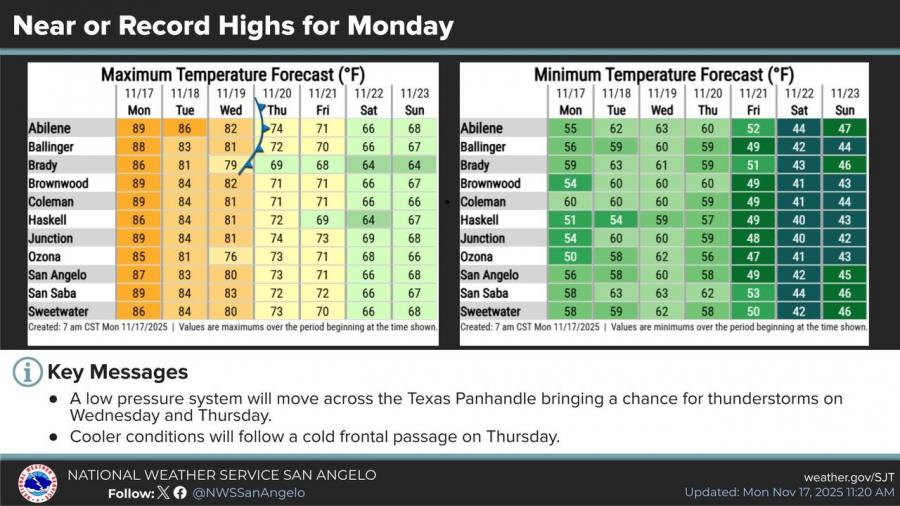
Temperatures are expected to cool after the front moves through. Prior to that change, the San Angelo Regional Airport reached a new record high of 89 degrees Sunday afternoon, surpassing the previous Nov. 15 record of 87 set in 2021, according to the National Weather Service.


Subscribe to the LIVE! Daily

Required
Post a comment to this article here: