

SAN ANGELO, TX — A cold front is expected to bring increasing rain chances and cooler temperatures to West Central Texas this weekend, the National Weather Service reported Thursday.
Mostly sunny and mild conditions will continue through Friday, with highs in the low to mid-70s across the region, according to the NWS office in San Angelo.
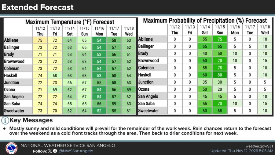
Rain chances rise Saturday and Sunday as the front moves through, with precipitation probabilities generally ranging from 35% to 65% on Saturday and 20% to 80% on Sunday. The highest chances Sunday are forecast for northern areas, including about 80% in Haskell, 75% in Abilene and Coleman, and 70% in Brownwood and San Saba.
Lower chances are expected farther south, such as 45% in San Angelo and 20% to 30% near Junction and Ozona. Forecasters said there is a 10% to 30% chance of at least a half-inch of rain along the Interstate 10 corridor and a 40% to 60% chance of that amount across the Big Country and northern parts of the Concho Valley and Heartland.
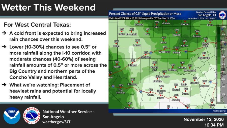
Officials are monitoring the placement of the heaviest rainfall and the potential for localized flooding. High temperatures are expected to fall into the mid-60s on Saturday and remain in the low to mid-60s on Sunday before dropping into the mid-50s on Monday behind the front.
Abilene and San Angelo are forecast to reach about 54 degrees Monday, with Sweetwater near 52. Conditions are expected to turn drier next week, with highs gradually rising back into the 60s by midweek.


Subscribe to the LIVE! Daily

Required
Post a comment to this article here: