

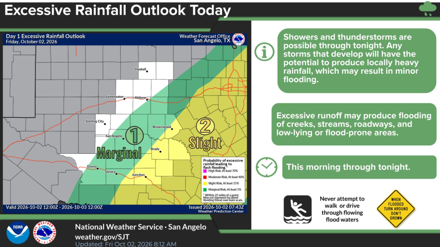
SAN ANGELO, TX -- The National Weather Service expects showers and thunderstorms to redevelop across West Central Texas on Friday and continue through the night, bringing a marginal to slight risk of excessive rainfall that could cause minor flooding.
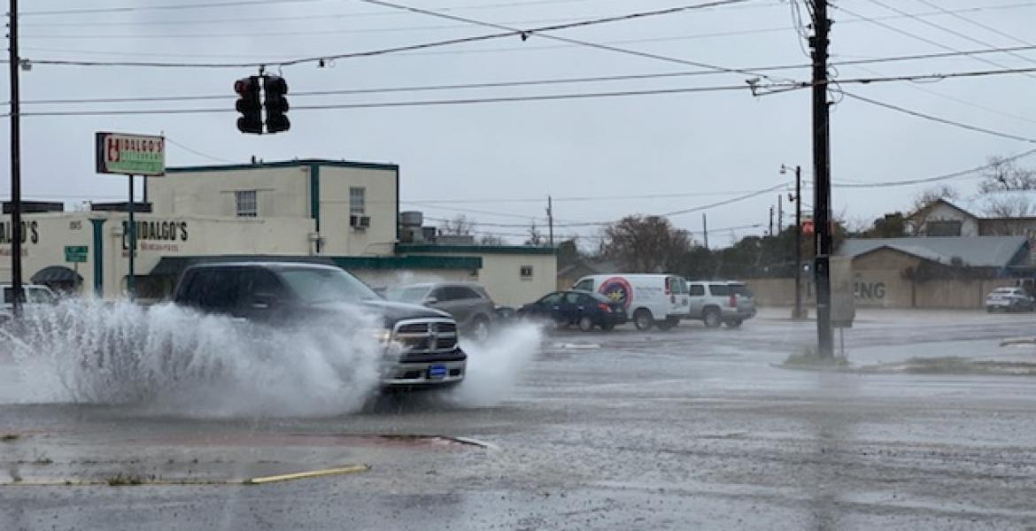
Any storms that form have the potential to produce locally heavy rain, and runoff may flood creeks, streams, roadways and low-lying areas, forecasters said. The threat runs from Friday morning through Friday night and is highest across the Northwest Hill Country and portions of the Heartland and Northern Edwards Plateau. A slight risk covers areas including Brownwood and Brady, while a marginal risk includes San Angelo and surrounding communities.
San Angelo’s forecast calls for a slight chance of showers between 1 p.m. and 4 p.m., then a chance of showers and thunderstorms after 4 p.m. The high will be near 80 under mostly cloudy skies, with a north-northeast wind of 10 to 15 mph and a 40% chance of precipitation.
Showers become likely after 7 p.m., with a low around 59 and a 60% chance of rain. New rainfall of a quarter- to a half-inch is possible. North winds will continue at 10 to 15 mph.
Saturday will be cooler, with showers likely mainly before 10 a.m., a high near 75 and a 60% chance of precipitation. Less than a tenth of an inch of additional rain is expected. The chance of showers drops to 20% Saturday night, with a low around 60.
A 30% chance of showers remains before 1 p.m. Sunday, with a high near 80 under mostly cloudy skies. North-northeast winds of 5 to 10 mph could gust to 20 mph. The low Sunday night will be around 60.
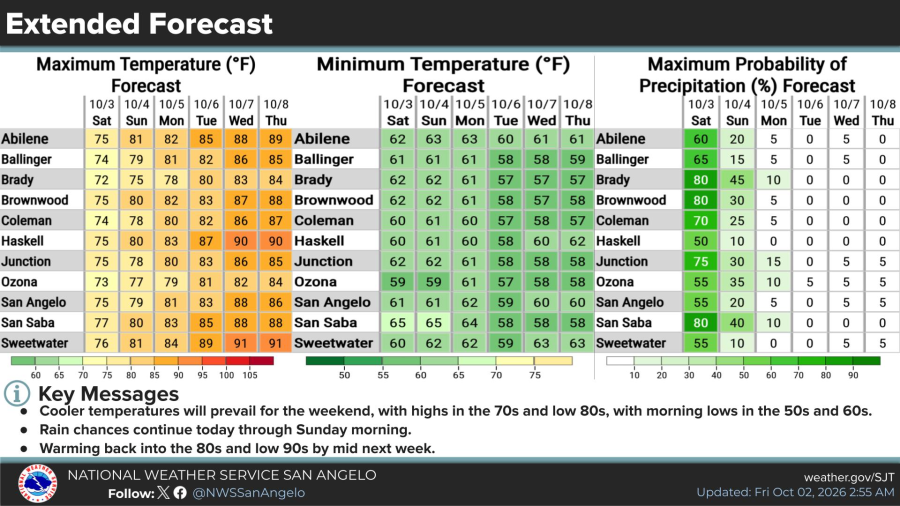
Across the region, Saturday highs are forecast in the low to mid-70s, with precipitation chances of 50% to 80%. Chances fall to 10% to 45% on Sunday. Morning lows through the weekend will generally be in the upper 50s to mid-60s.
Drier and warmer weather returns next week. Monday is expected to be mostly sunny with a high near 80 in San Angelo, followed by sunny skies and highs in the low to mid-80s Tuesday and Wednesday, then near 87 on Thursday. Most locations are forecast to reach the mid-80s to low 90s by midweek, with little to no chance of rain after Sunday morning.
Subscribe to the LIVE! Daily

Required
Post a comment to this article here: