

SAN ANGELO, TX — A slow-moving line of thunderstorms is expected to develop late Wednesday afternoon just west of a San Angelo-to-Sweetwater line and move across the area overnight into Thursday morning, the National Weather Service stated in a morning briefing.
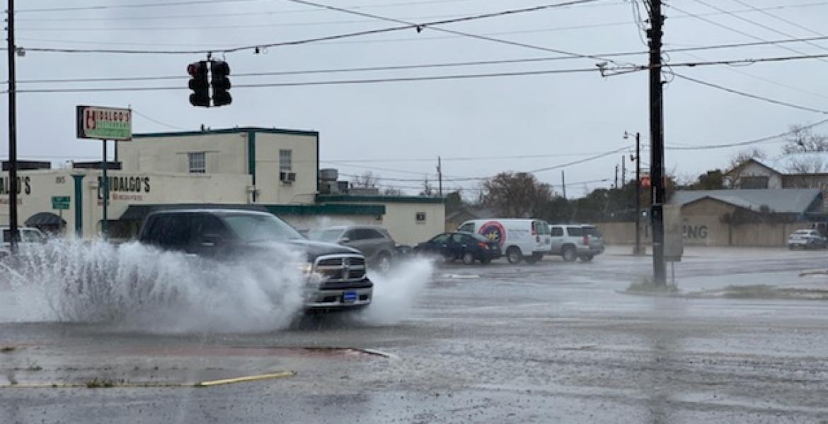
Heavy rain and flooding are the primary threats. Storms could produce 1 to 3 inches of rain in a short time. Because they will move slowly, amounts may add up quickly. Many areas are likely to see a couple of inches. A few locations that see repeated storms could receive 6 to 8 inches or more.
“Yes, we need the rain, but that’s too much for anybody in a short amount of time,” the NWS office serving San Angelo stated. Officials noted that 2 inches is only a rough average and that some areas may receive far less. Storms can vary sharply from block to block and from one side of the city to the other, they stated. No specific totals are guaranteed.
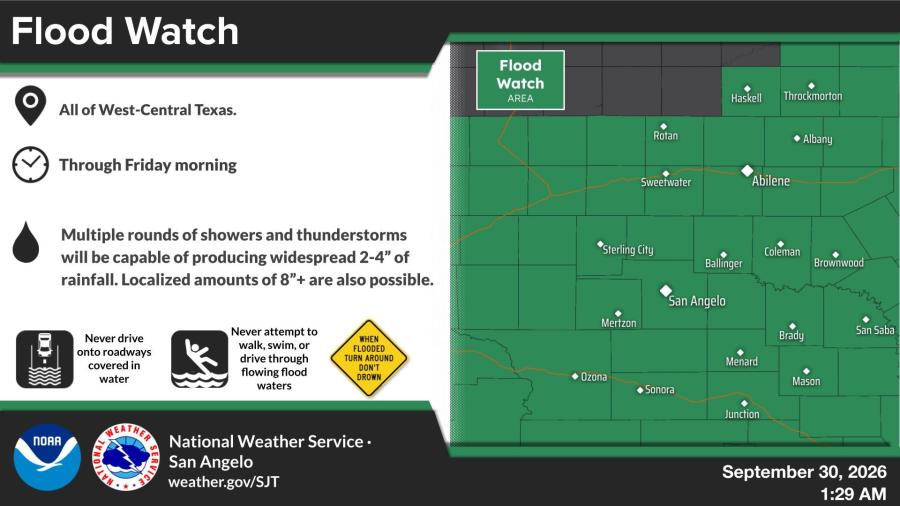
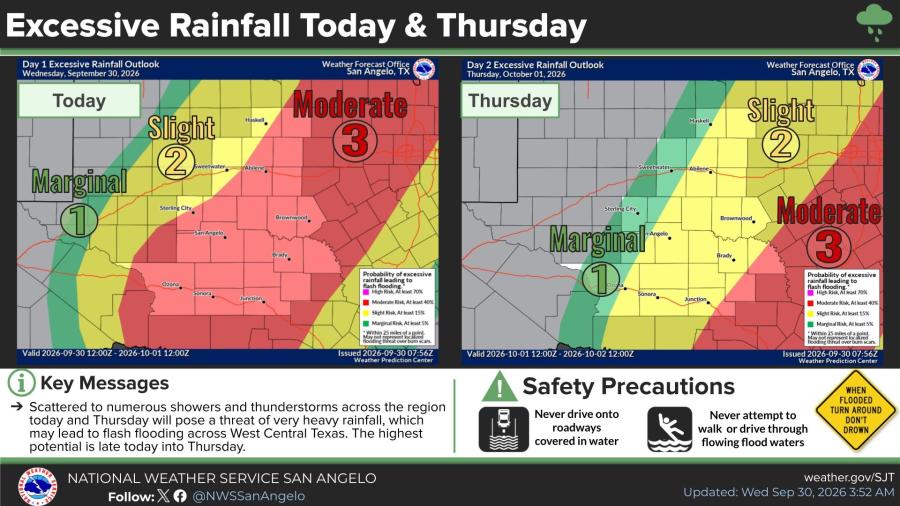
A Flood Watch remains in effect through Friday morning for West-Central Texas, including the San Angelo area. Widespread rainfall of 2 to 4 inches is likely, with isolated totals of 8 inches or more possible. The NWS excessive rainfall outlook shows a slight to moderate risk of flash flooding today, with the higher potential late Wednesday into Thursday.
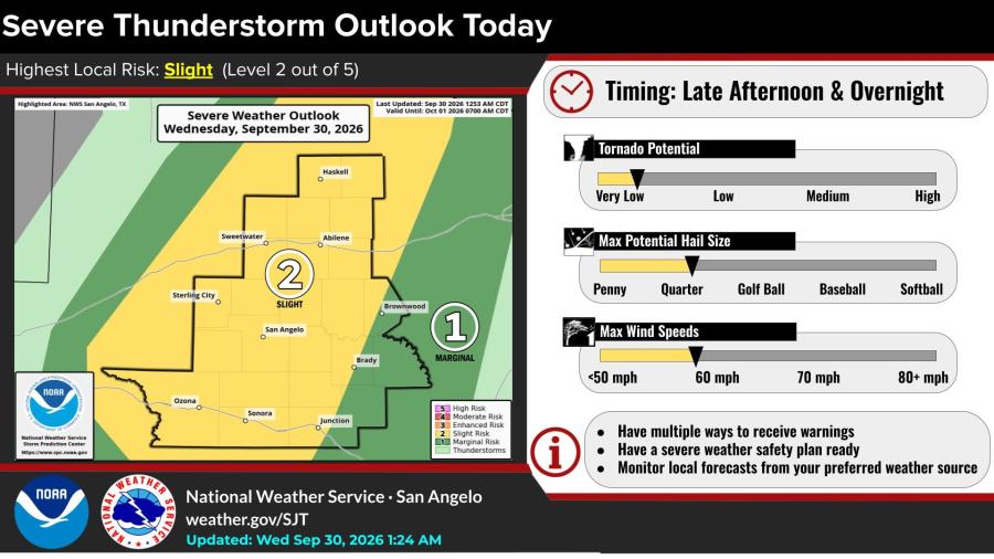
Isolated storms could still become severe. The NWS has a slight risk (level 2 of 5) of severe thunderstorms this afternoon and overnight across much of the area, including San Angelo. Forecasters expect hail of one-half inch to quarter-size and wind gusts around 60 mph on a few storms. Tornado potential is very low to low, and a brief tornado is possible Wednesday evening. The NWS said this is not a spring-like severe weather setup.
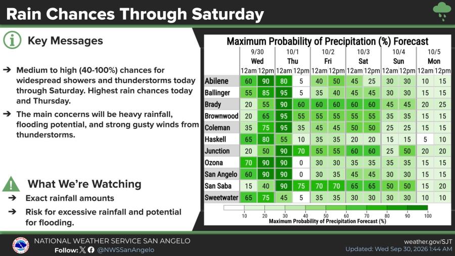
Rain chances for San Angelo are 90% this afternoon and remain high overnight into Thursday before dropping. Medium to high chances of showers and thunderstorms continue through Saturday.
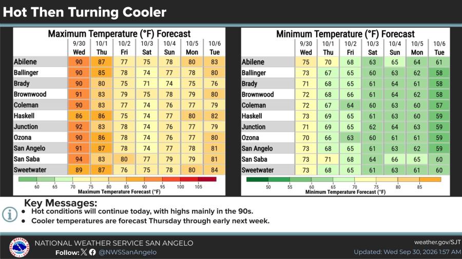
High temperatures will reach 91 degrees Wednesday before a cooling trend begins. Thursday’s high is forecast at 87, with readings falling into the 70s by Friday. The NWS said the pattern is complicated and that timing, location, and rainfall amounts could change. Additional updates are expected through the day. Residents should never drive onto roads covered in water.


Subscribe to the LIVE! Daily

Required
Post a comment to this article here: