

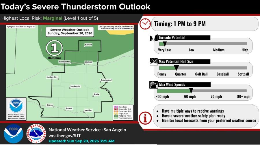
SAN ANGELO, TX — Thunderstorms are possible Sunday afternoon and evening across the San Angelo forecast area, with a marginal risk of isolated severe storms mainly along and north of Interstate 20, the National Weather Service said.
The highest local risk is Level 1 of 5. Storms are most likely between 1 p.m. and 9 p.m. Primary hazards include lightning, wind gusts to 60 mph, isolated hail up to quarter size, and locally heavy rain.
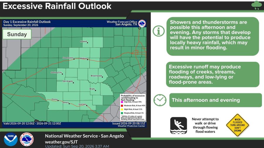
Any storms that develop could produce brief heavy downpours capable of causing minor flooding of low-lying areas, roadways, creeks and streams, according to the Day 1 excessive rainfall outlook. The risk of flash flooding is generally marginal.
The National Weather Service advised residents to have multiple ways to receive warnings, keep a severe-weather safety plan ready, and never walk or drive through flowing floodwaters.
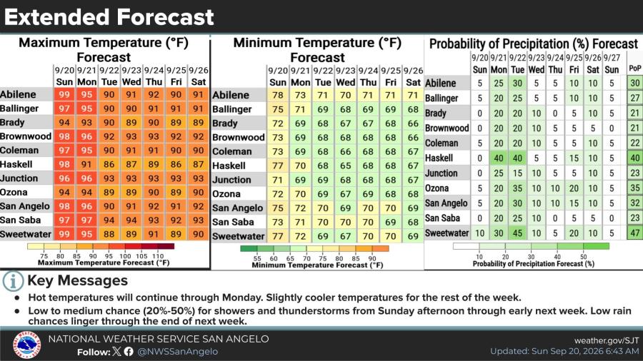
Sunday highs are forecast in the mid-90s to near 100, including 98 in San Angelo, 99 in Abilene and Sweetwater, and 94 in Brady and Ozona. Overnight lows Sunday night will be in the low to mid-70s.
Hot weather is expected to continue through Monday before temperatures ease slightly for the rest of the week. Rain chances rise from Sunday afternoon into Tuesday, with probabilities generally 20% to 45% Monday and Tuesday in many locations before dropping later in the week.
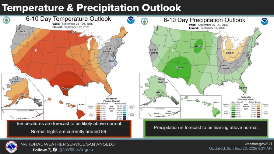
The 6- to 10-day outlook covering Sept. 25-29 calls for temperatures to remain slightly above normal, with normal highs near 89. Precipitation is leaning above normal.

Subscribe to the LIVE! Daily

Required
Post a comment to this article here: