
SAN ANGELO, TX — A severe thunderstorm watch was issued Tuesday afternoon for portions of central Texas, including the San Angelo area, where strong storms could produce tennis ball-size hail and damaging winds through late evening.
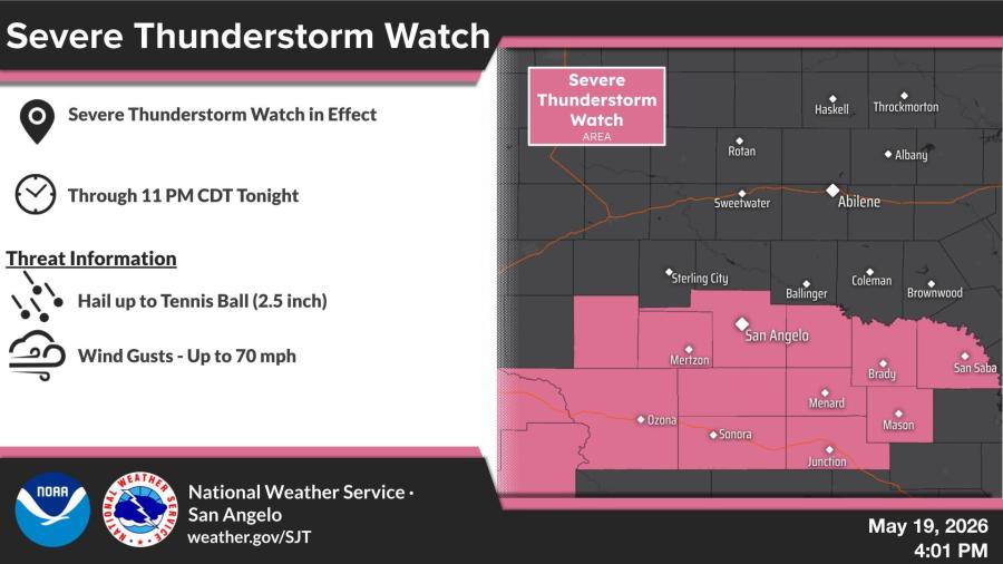
The National Weather Service in San Angelo/Abilene placed a severe thunderstorm watch in effect until 11 p.m. for areas south of a line from San Angelo to Brady to San Saba. The watch extends southward to the Interstate 10 corridor from Ozona to Sonora to Junction. Communities in the watch area include San Angelo, Brady, San Saba, Menard, Mason, Junction, Sonora, Eldorado, Mertzon and Ozona.
Forecasters said the strongest storms could produce hail up to 2.5 inches in diameter and wind gusts up to 70 mph. Frequent lightning is also possible.
The watch covers an estimated population of 324,623, along with 213 schools and 22 hospitals.

")

Subscribe to the LIVE! Daily

Required
Post a comment to this article here: