
SAN ANGELO, TX — Scattered severe thunderstorms are expected across West Central Texas this afternoon and evening along a cold front, the National Weather Service office in San Angelo said Tuesday.
The storms will be capable of producing large hail up to golf ball size or larger — potentially exceeding 2 inches in diameter — and damaging winds around 60 mph, forecasters said. Tornado chances are low but not zero.
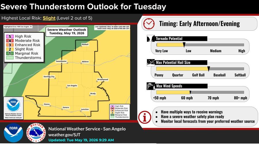
The highest local risk is “Slight,” or Level 2 out of 5. Abilene is most likely to see storms this morning into early afternoon. San Angelo and Brownwood are in the mid-to-late afternoon window, while areas around Brady and the I-10 corridor could see activity from late afternoon into early evening.
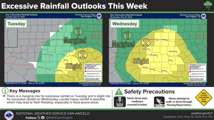
A marginal risk of excessive rainfall exists Tuesday, increasing to a slight risk Wednesday. Locally heavy downpours could lead to flash flooding, especially in low-lying and urban areas, forecasters warned.
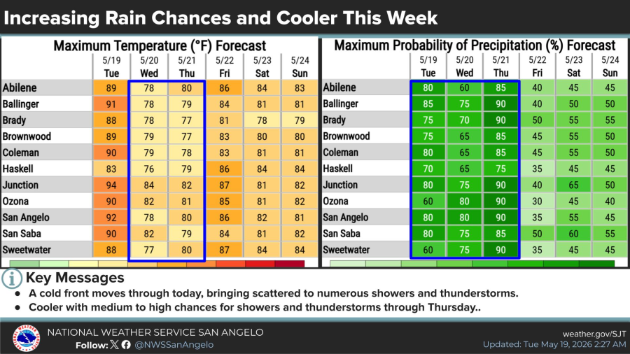
A cold front is bringing cooler temperatures and medium-to-high rain chances through Thursday. High temperatures are forecast to drop into the upper 70s Wednesday after reaching the low 90s Tuesday in San Angelo.

")

Subscribe to the LIVE! Daily

Required
Post a comment to this article here: