
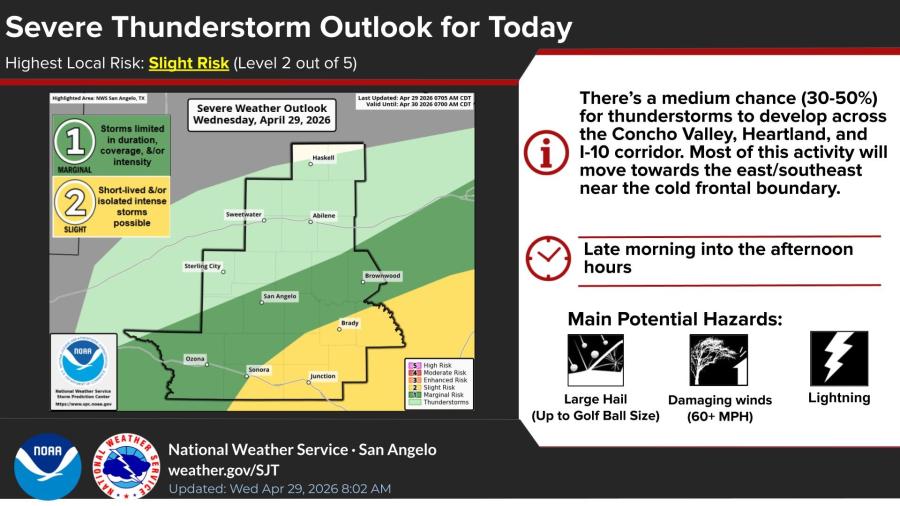
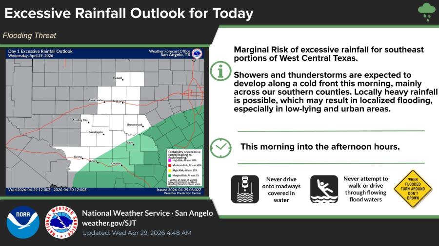
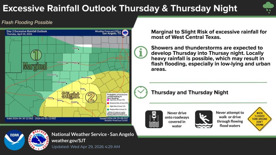
SAN ANGELO, TX — Marginal to slight risks of excessive rainfall and a slight risk of severe thunderstorms will bring locally heavy rain, possible flash flooding and isolated large hail to West Central Texas from Wednesday through Friday.
The National Weather Service in San Angelo says showers and a few thunderstorms are possible mainly across southern counties Wednesday morning into the afternoon. An isolated storm or two could produce large hail up to golf ball size and wind gusts of 60 mph or higher.
A marginal risk of excessive rainfall exists today for southeast portions of West Central Texas, with locally heavy rain possible along a cold front. The risk increases to marginal-to-slight Thursday and Thursday night for most of the region.
Forecasters say medium to high chances (60% to 90%) of at least 1 inch of rain cover much of West Central Texas from Thursday morning through Saturday morning.
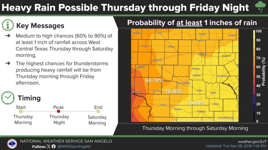
Peak thunderstorm and heavy rain chances are expected Thursday night.

")

Subscribe to the LIVE! Daily

Required
Post a comment to this article here: