
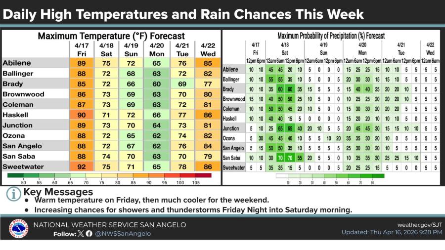
SAN ANGELO, TX — Rain and thunderstorm chances will continue from Friday afternoon through Saturday morning across much of West Central Texas as a strong cold front moves through the region.
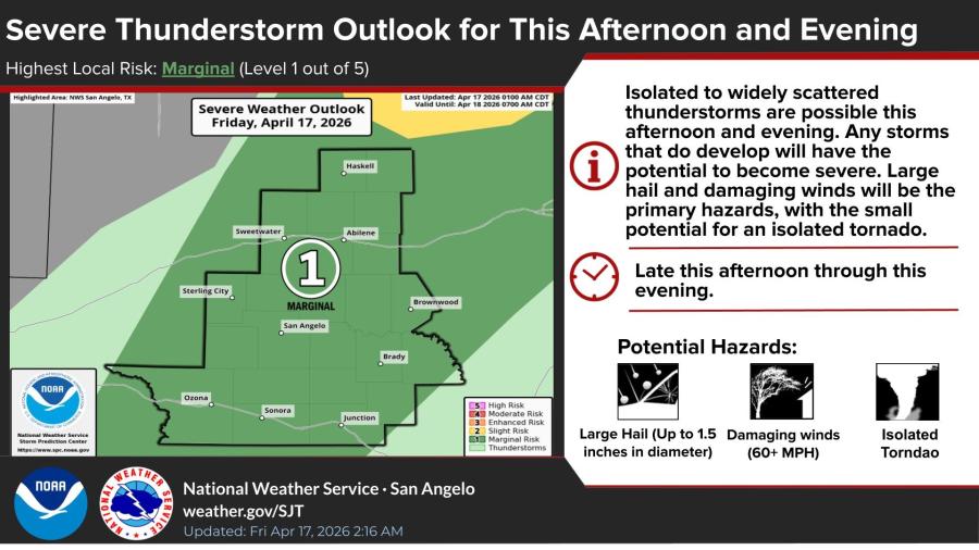
The National Weather Service in San Angelo has placed the area under a marginal risk of severe thunderstorms for this afternoon and evening. Isolated to widely scattered storms are possible, with the main threats being large hail up to 1.5 inches in diameter, damaging winds of 60 mph or greater and a small potential for an isolated tornado.
Friday will be the warmest day before the front arrives, with highs reaching the upper 80s to low 90s in many spots. The best rain chances will be late this afternoon through tonight.
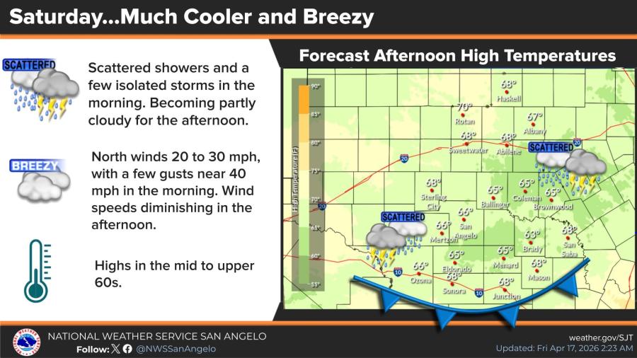
Saturday will turn much cooler and breezy behind the cold front. Scattered showers and a few isolated storms are possible mainly in the morning, becoming partly cloudy in the afternoon. High temperatures will only climb into the mid to upper 60s under north winds of 20 to 30 mph, with gusts near 40 mph early in the day.
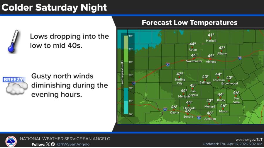
Low temperatures Saturday night are expected to drop into the low to mid 40s, with gusty north winds diminishing during the evening hours.


Subscribe to the LIVE! Daily

Required
Post a comment to this article here: