
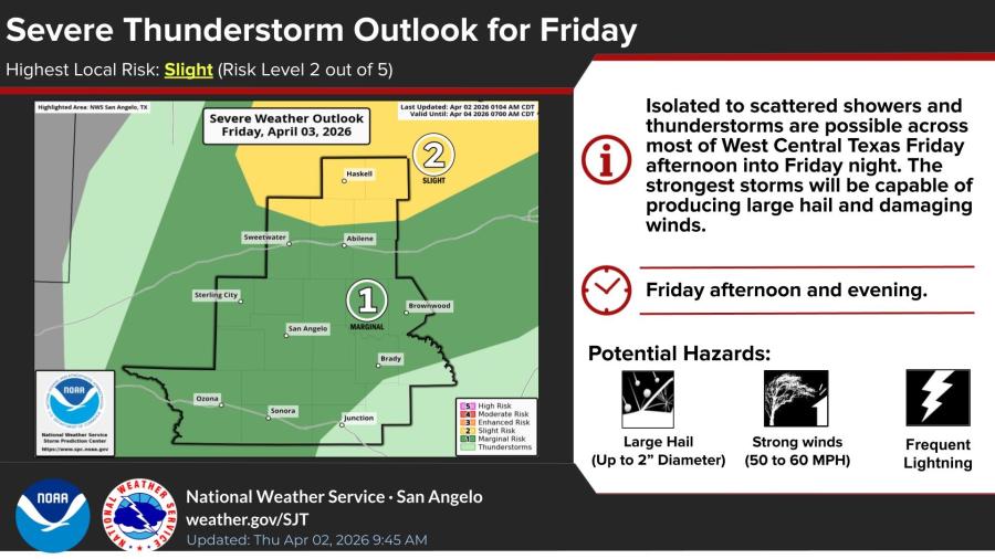
SAN ANGELO, TX — Strong to severe thunderstorms capable of large hail up to 2 inches in diameter and damaging winds of 50 to 60 mph are possible across much of West Central Texas Friday afternoon into Friday night, the National Weather Service office in San Angelo said Thursday.
The NWS has placed most of the region under a marginal risk — level 1 of 5 — for severe thunderstorms, its highest local risk level. Isolated to scattered storms are expected to develop by early afternoon, with coverage increasing through the evening. The strongest storms will also produce frequent lightning, forecasters said.
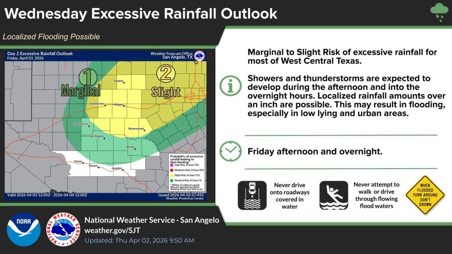
A marginal to slight risk of excessive rainfall also exists for most of the area, with showers and thunderstorms expected to produce localized totals of more than an inch. That could lead to flooding in low-lying and urban areas, especially in the Big Country, according to the Day 2 excessive rainfall outlook.
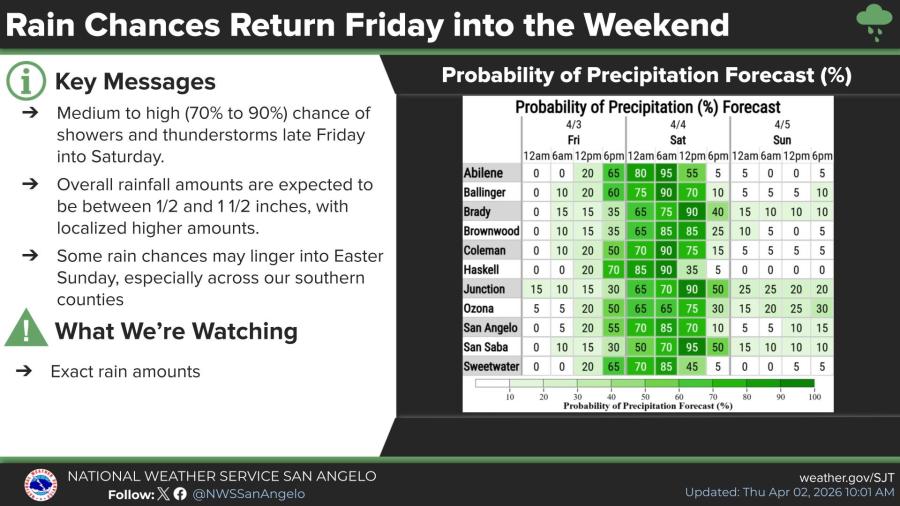
Rain chances will be medium to high — 70% to 90% — late Friday into Saturday, the NWS said. Overall rainfall amounts are forecast between a half-inch and 1.5 inches, with some spots seeing higher totals. A few rain chances may linger into Easter Sunday, particularly across southern counties.
The forecast comes after much of the area received beneficial rainfall the previous night. The NWS Abilene/San Angelo office asked residents Thursday to report any wind damage or large hail from those storms, including location, hail size and estimated or measured diameter.

")

Subscribe to the LIVE! Daily

Required
Post a comment to this article here: