
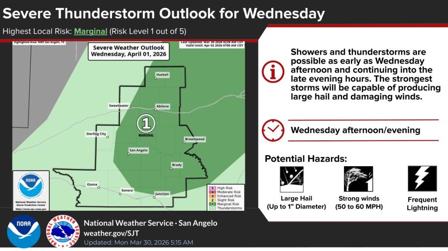
SAN ANGELO, TX — Showers and thunderstorms with a marginal risk of severe weather are possible Wednesday afternoon and evening across much of the San Angelo region, the National Weather Service said Monday.
The strongest storms could produce large hail up to 1 inch in diameter and damaging winds of 50 to 60 mph, forecasters said. Lightning will be frequent. The greatest severe threat is generally east of a line from Sweetwater to Sterling City to Ozona.
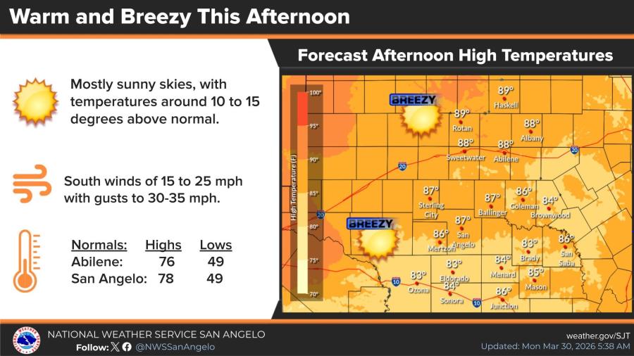
Monday will be warm and breezy under mostly sunny skies. High temperatures are forecast in the mid- to upper 80s, about 10 to 15 degrees above normal. South winds will blow 15 to 25 mph with gusts up to 30 to 35 mph.
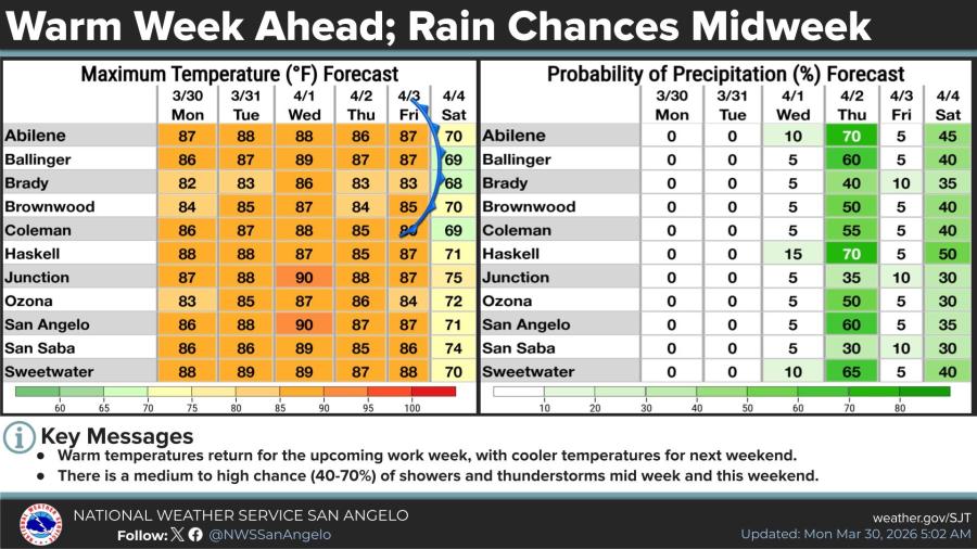
Warm temperatures will continue through Friday, with highs mostly in the 80s and low 90s. Rain chances increase midweek, with a 5% to 15% probability Wednesday and a 40% to 70% probability Thursday in many communities. Additional rain chances return this weekend.

")

Subscribe to the LIVE! Daily

Required
Post a comment to this article here: