
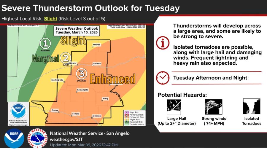
UPDATE: The National Weather Service has upgraded the severe thunderstorm outlook for Tuesday to an enhanced risk, rated level 3 out of 5, with the risk area covering parts of West Central Texas, including San Angelo, Brady, and Brownwood. Updated hazards include large hail up to 2+ inches in diameter, damaging winds of 74 mph or greater, isolated tornadoes, frequent lightning and heavy rain.
SAN ANGELO, TX — A low-pressure system moving into West Central Texas is expected to bring severe thunderstorms and a risk of flash flooding Tuesday afternoon and night, according to the National Weather Service.
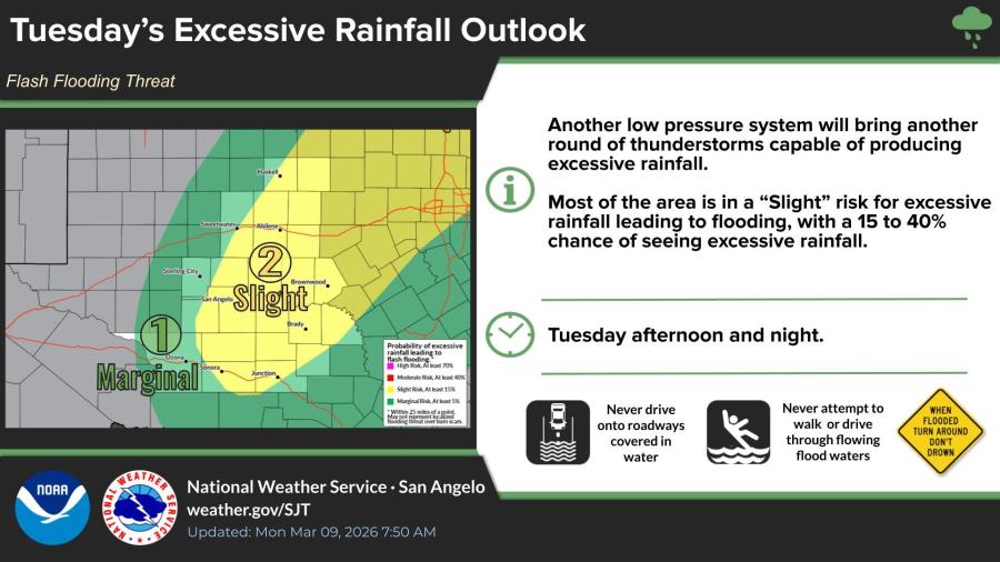
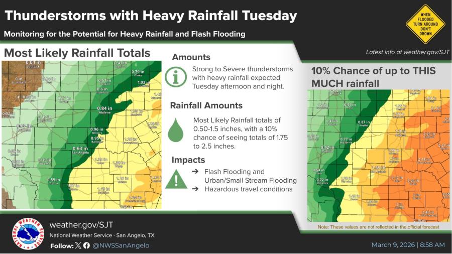
A separate slight risk for excessive rainfall warns of possible flash flooding, with a 15% to 40% chance of excessive amounts leading to hazardous travel conditions. Most areas could see rainfall totals of 0.50 to 1.5 inches, with a 10% chance of totals reaching 1.75 to 2.5 inches or more in some spots. Urban and small stream flooding is a concern, and residents are advised to avoid flooded roadways.
The system will approach from the west Tuesday, with thunderstorms developing across a large region.
Weekly high temperature forecasts show a cooldown midweek. In San Angelo, highs are expected to reach 82 degrees Monday, 79 Tuesday, 73 Wednesday, 71 Thursday, 84 Friday, 89 Saturday and 89 Sunday.
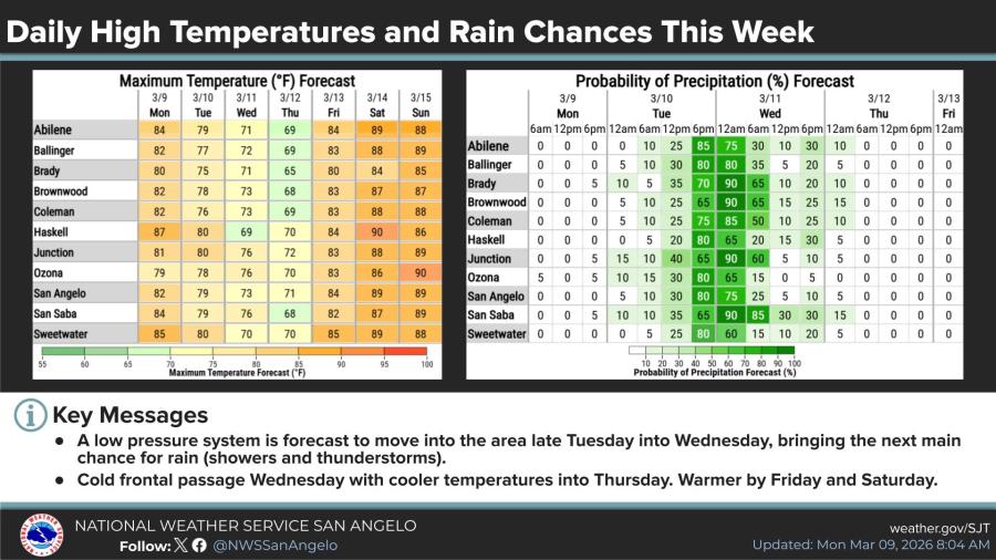
Precipitation probabilities peak Tuesday and Wednesday, ranging from 75% to 80% in San Angelo during daytime hours, before dropping to near zero by week's end.
A cold front is expected Wednesday, bringing cooler temperatures into Thursday. Dry and warmer conditions are forecast Friday and Saturday.

")

Subscribe to the LIVE! Daily

Required
Post a comment to this article here: