
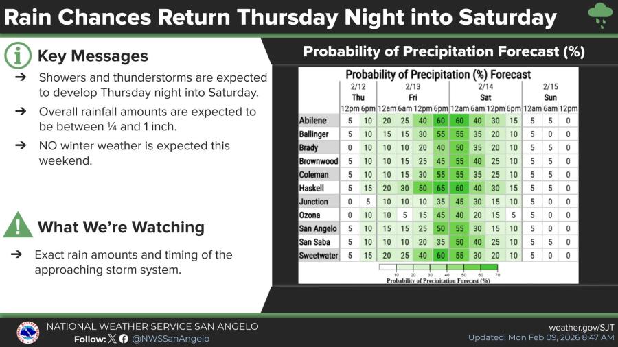
SAN ANGELO, TX — Showers and thunderstorms are expected to develop across West Central Texas from Thursday night into Saturday, bringing the best chance for measurable rainfall this week, the National Weather Service in San Angelo said Monday.
Forecasters said overall rainfall amounts will generally range from one-quarter to 1 inch, with no winter weather expected.
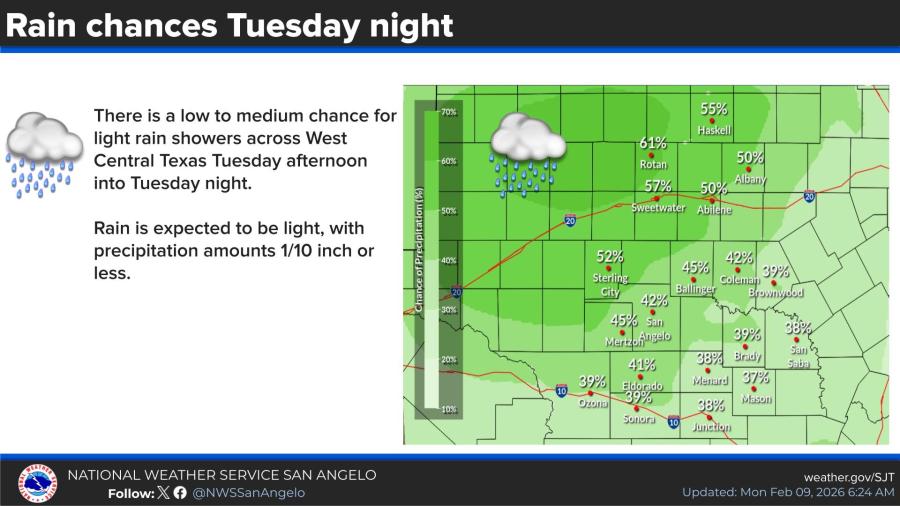
A lower chance for light showers exists Tuesday afternoon into Tuesday night, with precipitation amounts of one-tenth of an inch or less.
Probability of precipitation peaks Friday and early Saturday, with many areas seeing 40% to 60% chances during that period. Cities such as Abilene, Haskell, and Sweetwater could see slightly higher odds, while southern locations like Ozona and Junction remain lower.
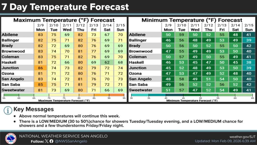
Above-normal temperatures will continue through the week. In San Angelo, highs are forecast to reach the low to mid-80s on Monday before cooling to the 70s Tuesday through Sunday, except for Thursday, which will peak again in the 80s. Lows will range from the upper 40s to the upper 50s most nights, dropping into the 40s by next Sunday.


")
Subscribe to the LIVE! Daily

Required
Post a comment to this article here: